After taking a long break from the site, I'm back.
I'll be updating the site with for info on Missouri Trails and I've added an Ozark Trail section to the website. Stayed tuned as those
| Ben's Hikes |
|
|
After taking a long break from the site, I'm back.
I'll be updating the site with for info on Missouri Trails and I've added an Ozark Trail section to the website. Stayed tuned as those Yesterday, the Missouri State Mountain Bike Championship was held at Castlewood with temperatures in the low 90's. We got to Castlewood about 8:50 and got registered. As I was starting my warm-up, I rode off the road and onto the race course in the grass. The grass was still wet with dew, I hit a wet root, and crashed. I was fine, but I had flatted my front tire. I thought tubeless weren't supposed to flat; I ran back to the car and changed my flat. After the crash and flat tire were fixed, it was 9:30. I took up and rode up Keifer Creek Road and came back on the Lone Wolf Trail in the creek valley. A little after 10, the five Juniors took off. I was the second rider into the singletrack. On the first part of the Grotpeter climb, I passed the other Junior ahead of me when he tried to ride over a log instead of around it. I kept a fast pace up the climb and passed about four Beginners before getting to Rollercoaster. After a little bit on Rollercoaster, I came up to five racers going slower than I wanted. The rider in front of me didn't want to let me pass him so I had to ride Rollercoaster pretty slow. After we got on the wide part of Grotpeter, I passed about four people before Mountain Ridge. I was stuck behind the rider who wouldn't let me pass him for the ride down mountain ridge. I passed about five people on the trail in the creek valley, before the creek crossing including the rider who didn't want me to pass. I rode across the creek and back throug the bottomlands to complete the 5.25 mile lap in about 28 minutes. I was first in my category and won a CO2 Inflation Kit and a State Champion Jersey. 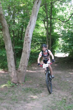 On June 1, I raced in the C Race at Tuesday Night Worlds. This was my first time racing at Cardondelet and didn't really know what do expect. I felt really good and stayed with the lead pack for the whole 25 minutes, but didn't stay with a breakway that happened with three laps left. It was a lot of fun, I averaged 23 mph, felt really good, but there are two things I need to work on. One, I never took a drink, and two, I always lost a lot of speed on the tight corner.  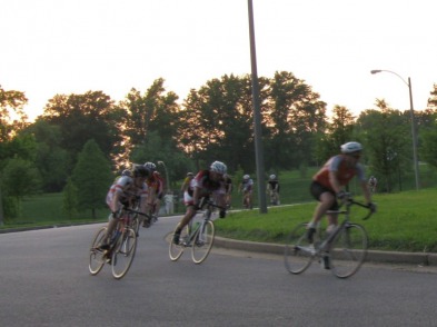 May 22 was the last Art/ Nature Field Trip of the year. Four times a year, the librarian and art teacher from North lead a group of about 20 kids to scenic natural areas around Missouri. Past destinations have been Hawn State Park, Klondike, Pickle Springs, Citygarden, Rocheport and many other spots. Last weekend, we headed south to Taum Sauk Mountain and Elepant Rocks State Parks. First, we spent an hour scrambling around the warm, pink granite boulders of Elephant Rocks. Then, we drove to Taum Sauk and ate lunch on the highest point in Missouri. After lunch, we hiked the three mile loop to Mina Sauk Falls. The glade views were awesome as usual and the waterfall was really flowing with all the recent rain. 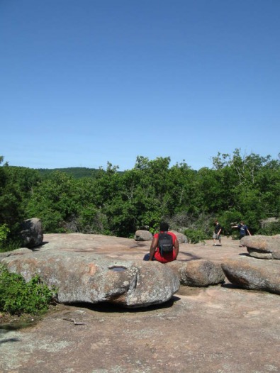 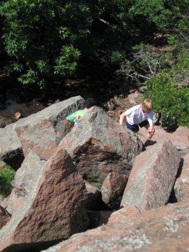 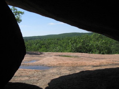 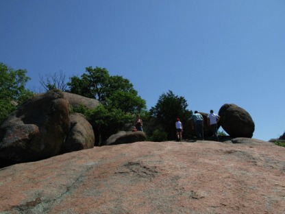 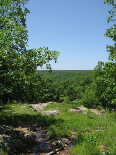 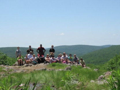 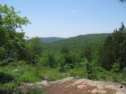 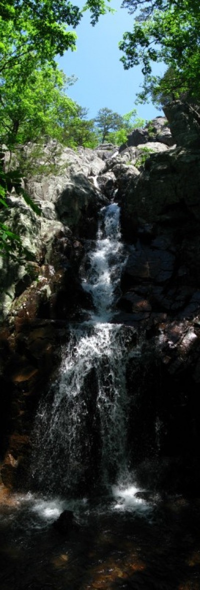 Last weekend was the 11th annual Rhett's Run Mountain Bike Race in Columbia, MO. The days leading up to the race had a lot of rain and I knew the 4.5 mile course was going to be muddy. When I stopped in at Mesa on Friday, Dave Breslin said to have mud tires on the bike for the race. I took his advice and got some better tires. I got a 2.3 Specialized Eskar in the front and a 2.25 Maxxis Ardent in the back. Both are more All Mountain tires, but they were a huge help in the race. Last Sunday, after I registered and got my shirt, I went out and pre-rode about 1.5 miles of the course. It was muddy, really, really muddy. The trail was rocky and rooty, but there was still muddy everywhere. This was a pretty big race for the Junior category; there were nice racers. After the start, I entered the singletrack near the back. The other juniors were sliding around and almost falling a lot on the muddy grass on the way to the singletrack. On the first downhill, they all started to bunch up. Soon after that, I started passing some of them on the first climb. For the rest of the climbs on that first muddy, slippery lap, I passed the other Juniors until I was in second. For the second lap, I kept up my pace and stayed in second. I rode most of this lap with a Marathon rider who flatted earlier in the race. I crossed the line in about an hour and 10 minutes. Pedaling through 9 miles of mud felt as hard as biking 20 miles on the road. I was happy with how I did, I felt pretty good overall and beat 7 other people. Hopefully the rest of the races will be more like Rhett's Run and have more than one other Junior. 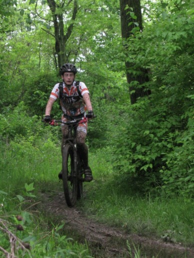 I hate mud 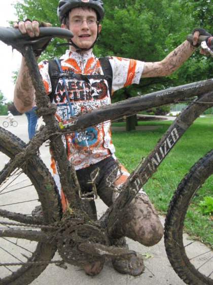 I had lots of bike cleaning to do after the race The Greensfelder Challenge Mountain Bike Race was the first race near St. Louis since March 14 that hadn't been rained out. I typed up a mcuh more detailed recap on the Mesa Racing site. You can read that here: http://www.mesacyclesracing.com/2010/05/greensfelder-challenge-recap/ 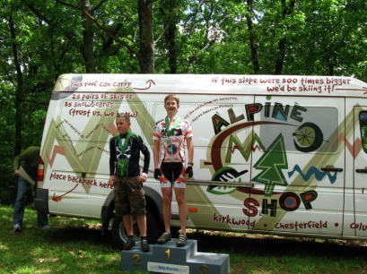 My friend and neighbor down the street, Mr. Sloan, recently gave me his old road bike. It is a Willier Triestina Izoard. I had never heard of Willeir before, but they are an Italian company who has been making handmade bikes for 100 years. It's a really nice bike. The components are all great, and it is all carbon fiber. The carbon makes it super light; it weighs 5 lbs. less than my CX bike and 10 lbs. less than my 29er. On the road, it is really fast and a lot of fun to ride. Here are some pictures: 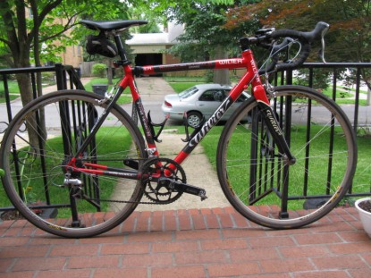 Today, I raced in the Tour of St. Louis's Delmarvelous Crit. The crit was near downtown St. Louis on Delmar and Martin Luther King Blvd. We woke up earlier and got there around 6:50, but the organizers, Big Shark weren't ready for registration for a while. I got my derailleur blocked out and rode a couple of laps. The course was a 0.8 mile rectangle. Since it was raining, there were puddles all over and the corners were pretty wet. The side of the course with the Start/ Finish was a smooth downhill, the other side was a rougher, wetter climb into the wind. Besides being wet and cold it was also really windy. Winds were in the low 20's gusting up to 32 mph. They were a little late starting the race. I was in second after the first two corners and then two more juniors pulled away. In a lap or two, I was with two Columbia Bike Club people. I stayed with them for the whole race. I pulled away from them on the last two corners, but got passed by one of them right before the finish line. Still, it was a fun race. Pretty soon, mountain bike racing around St. Louis will start to pick up. Greensfelder and Rhetts Run in May, and four races in June: two at Castlewood, one at Bromelsiek, and the rescheduled Lost Valley Luau. 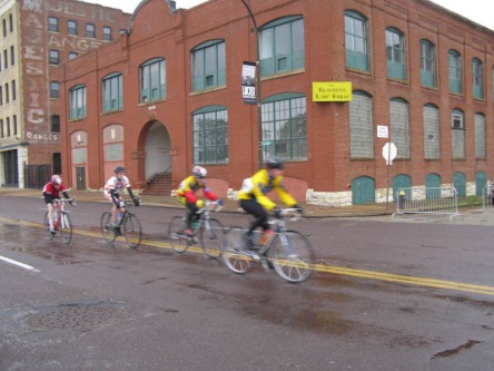 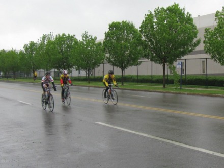 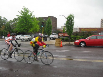 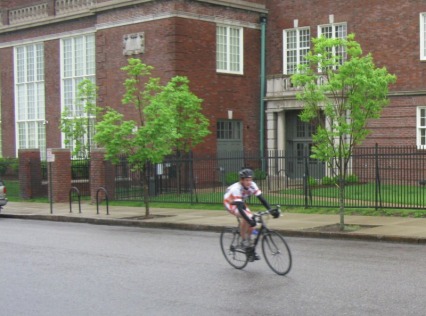 Last weekend, my mom and I took a hike around the loop trail at Valley View Glades Natural Area. This was our first time visiting the area, and it was beautiful. We had hoped to see lots of wildflowers; we weren't disappointed. There were tons of wilflowers in the glades and some in the forest. The sections of trail that were in the glades were great. Much of the trail traveled through the forest, but the many different creeks and streams had some really neat little waterfalls on them. We spent so much time admiring the wildflowers that it took us two hours to hike the two mile loop. We'll be coming back down Highway 21 soon to hike around Victoria Glades Conservation Area. 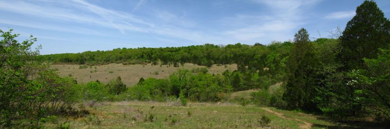 A panoramic view of the glades, click on the picture for a larger image 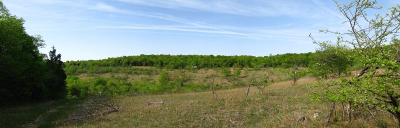 Another panoramic view of the glades, click for a larger image 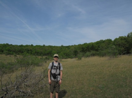 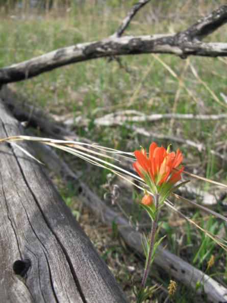 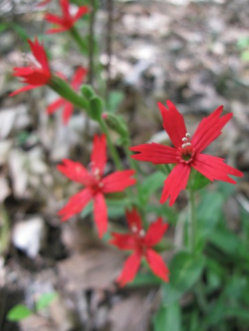 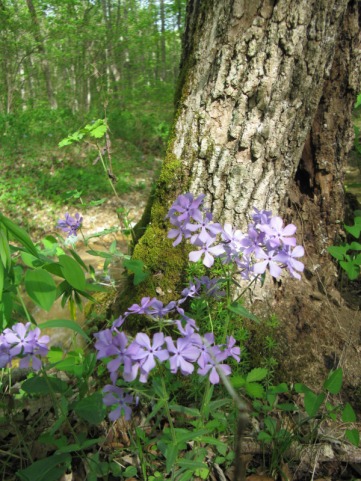 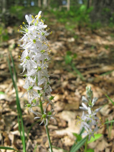 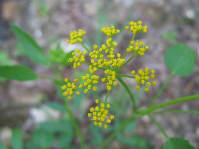 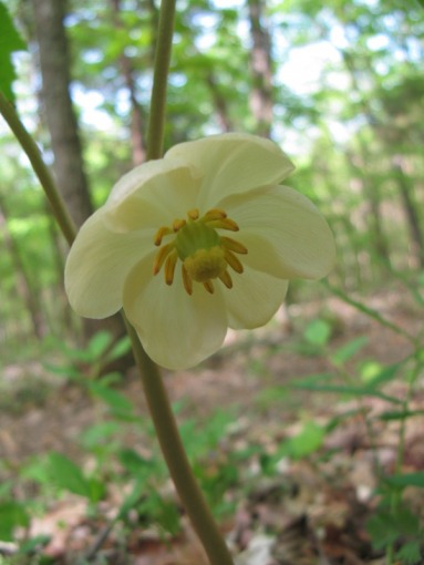 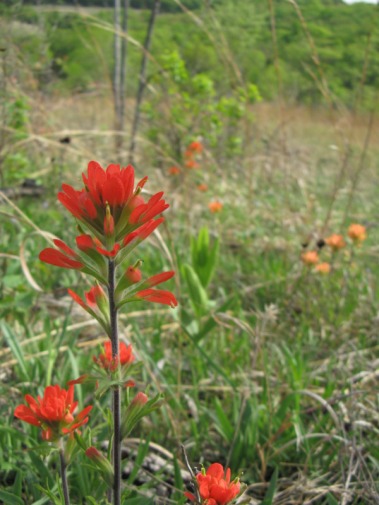 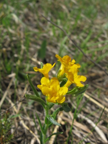 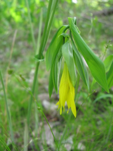 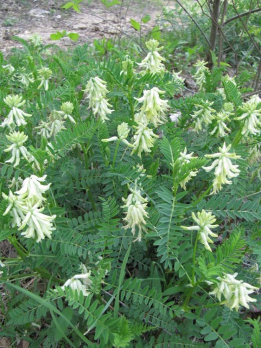 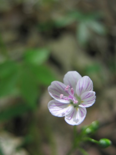 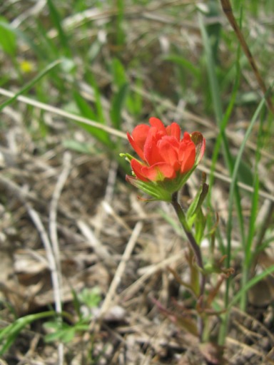 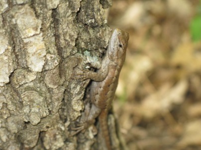 Wildflowers weren't the only thing we saw Yesterday, I did my first road road at the Tilles Park Crit. Crit, which is short for Criterem, is a kind of road race with many laps around a short course. I got to Tilles around 11:30. I registered in the Juniors 10-18 category and warmed up to get ready for the 12:15 start. Adrienne from Mesa told me crits start fast and then slow down some, and that I need to draft off other riders to save energy. After the race started, I was surprised that I could actually stay with the main pack of eight riders. We stayed together as a pack for the first 18 minutes. Then, four riders broke away. The four of us left stayed together for most of the rest of the race. After 20 minutes was up, we had four laps to go. One rider kind of broke away, but we caught him with two laps to go. Just as I was starting the final lap, I passed on the first downhill and tried to get away from the other three riders. About halfway through the lap, they fell back and I finished in fifth. I raced about 10.4 miles and averaged 21 mph. I think I did pretty good for my first road race considering I won a mountain bike race the day before, had a cyclocross bike, and was competing with older racers on way lighter carbon fiber bikes. Road racing was fun, and I liked it, but I still like mountain bike racing better. Throughout the year, I'll still do some road races. 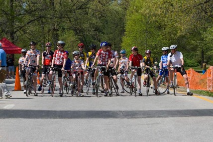 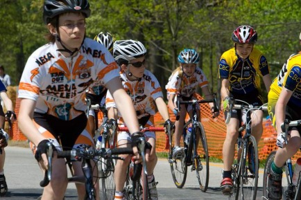 The start 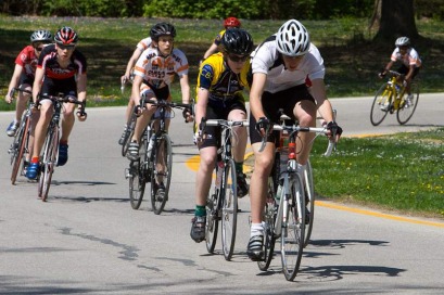 The main pack 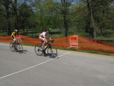 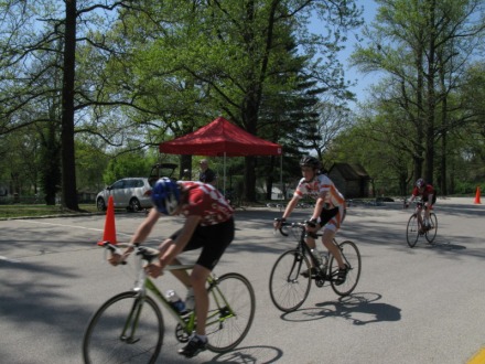 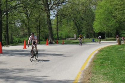 The finish |
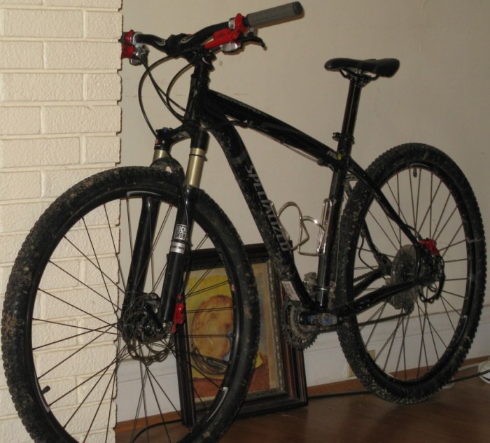
AuthorMy name is Ben. I love to read, hike, backpack, mountain bike, rock climb, and mountain bike race. Since there are so many great hikes in Missouri, I decided to make a website to describe them. 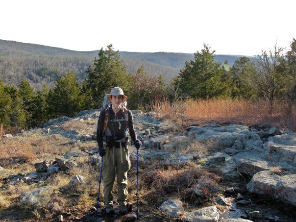 The Mountain BikeI ride a 2010 Specialized Rockhopper Expert 29er. I've upgraded all the original parts, went 1x9 and dropped 5lbs from the stock bike.
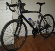
 My Road BikeI have Willier Izoard for road riding and racing.
 My CX BikeI ride a 2010 Specialized Tricross
 2010 Race ResultsRiver Trails Mountain Bike Challenge (Kansas)
1st Junior 15-18 Tilles Park Crit 5th Juniors 10-18 Delmarvelous Crit 5th Juniors 15-18 Greensfelder Challenge 1st Juniors 15-18 Rhett's Run 2nd Juniors 15-18 2009 Mtb. Race Results
ICCC Castlewood Race 5th Beginner 19 and under Greensfelder Classic 5th Beginner 19 and under Burning at the Bluff 3rd in Burnin Virgins Category Archives
January 2012
Categories
All
|
 RSS Feed
