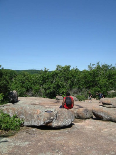
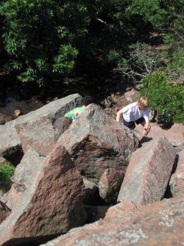
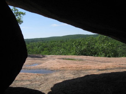
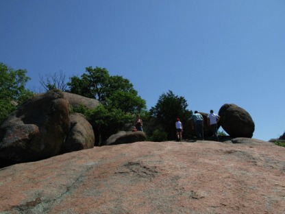
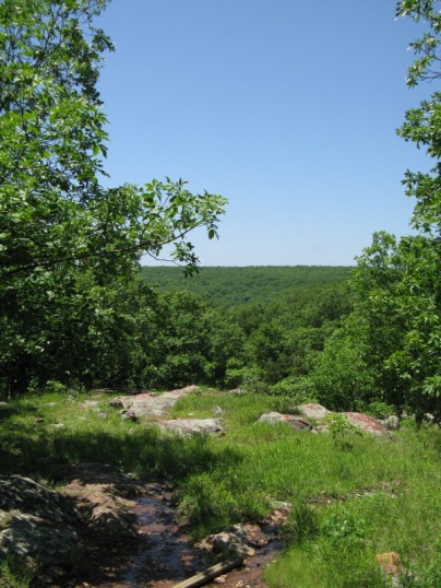
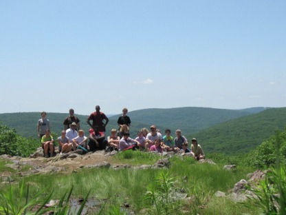
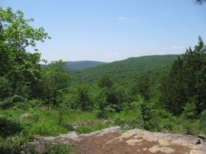
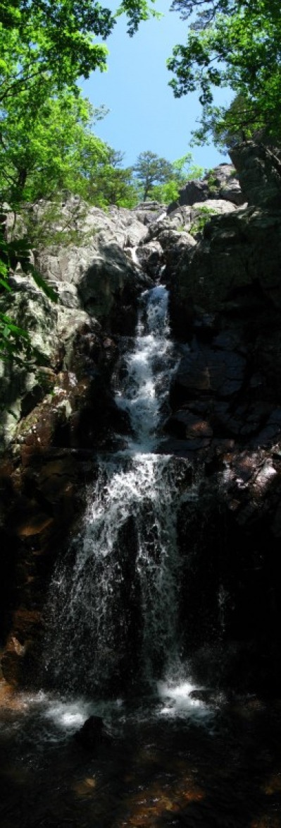
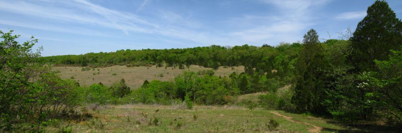
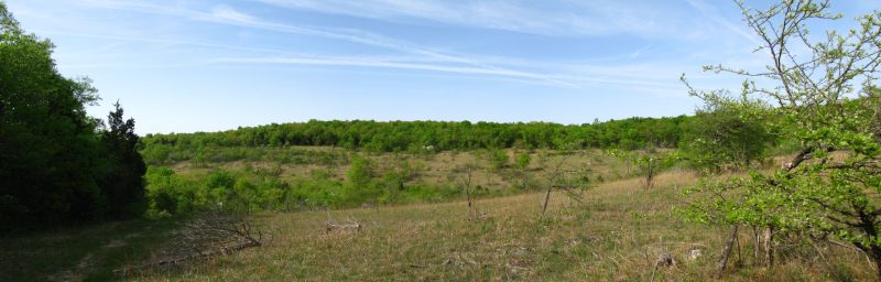
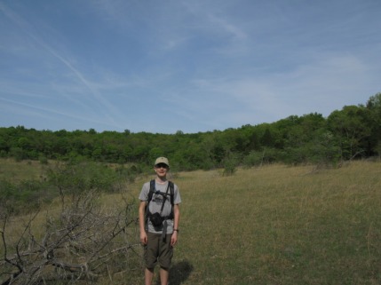
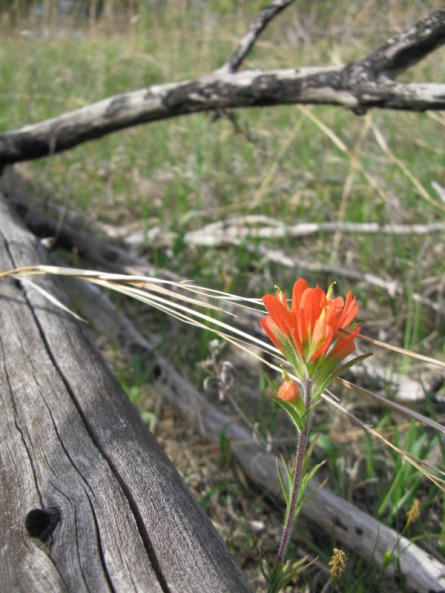
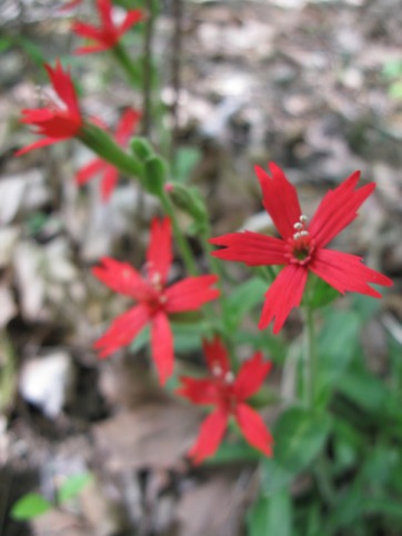
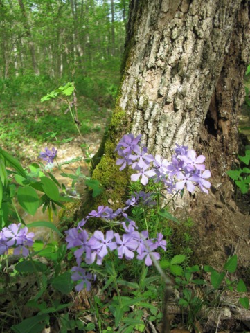
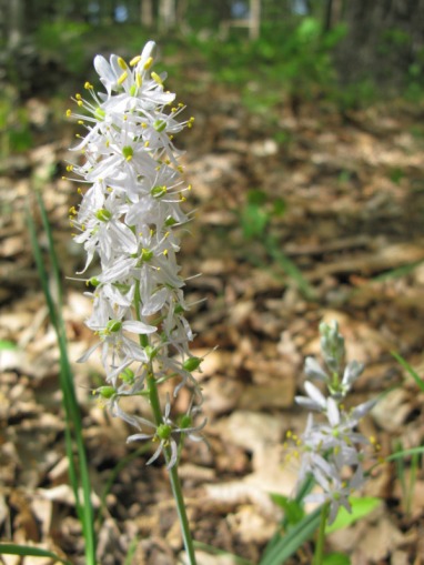
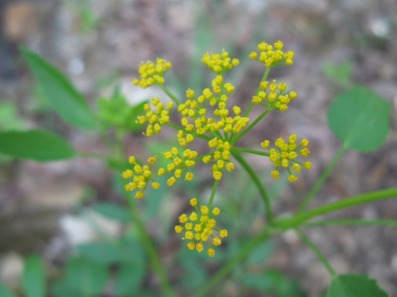
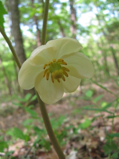
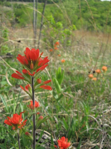
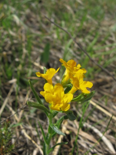
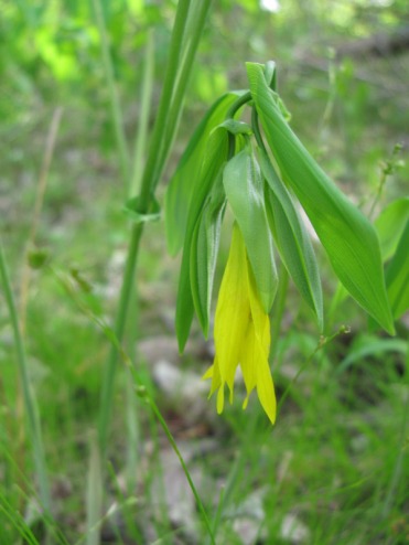
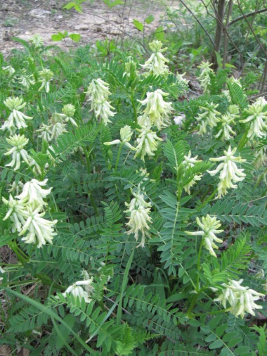
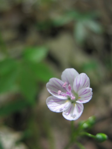
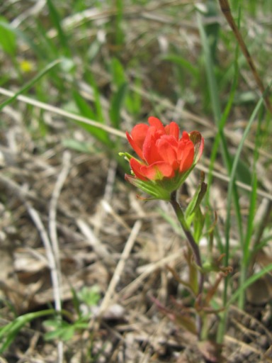
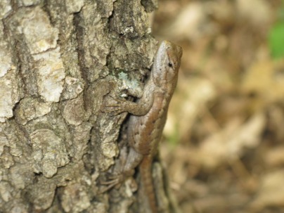
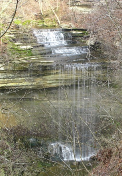
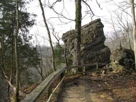
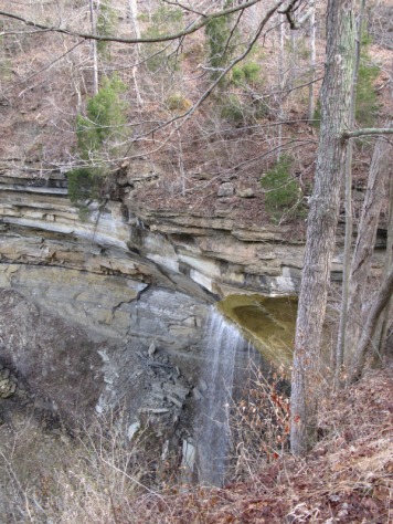
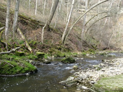
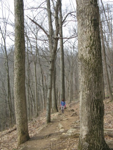
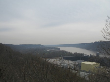
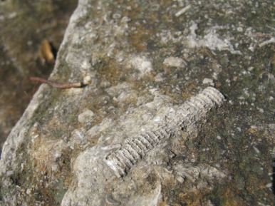
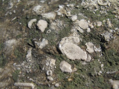
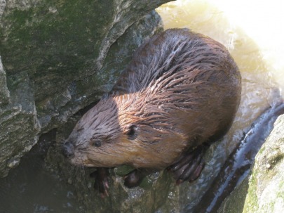
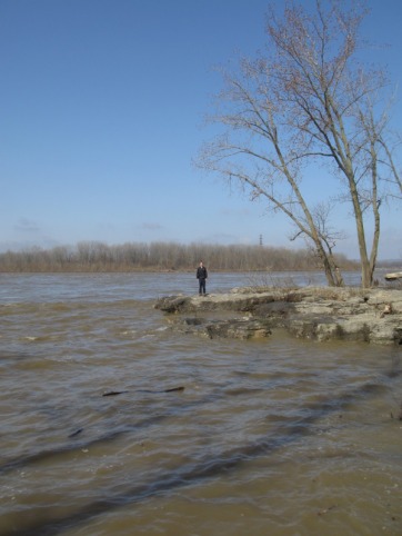
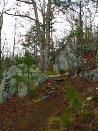
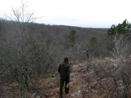
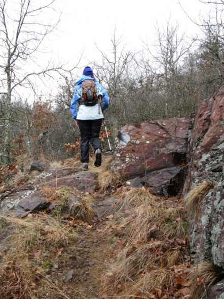
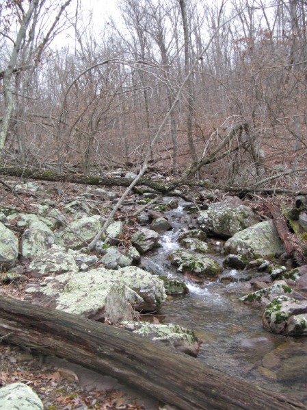
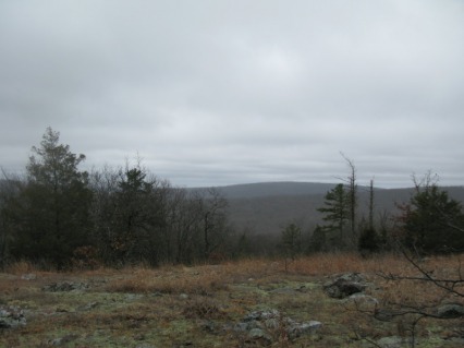
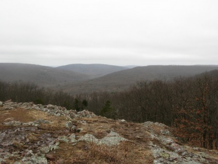
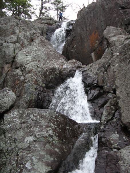
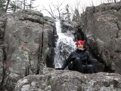
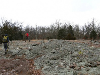
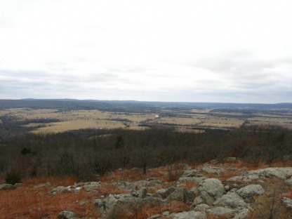
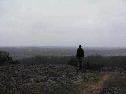
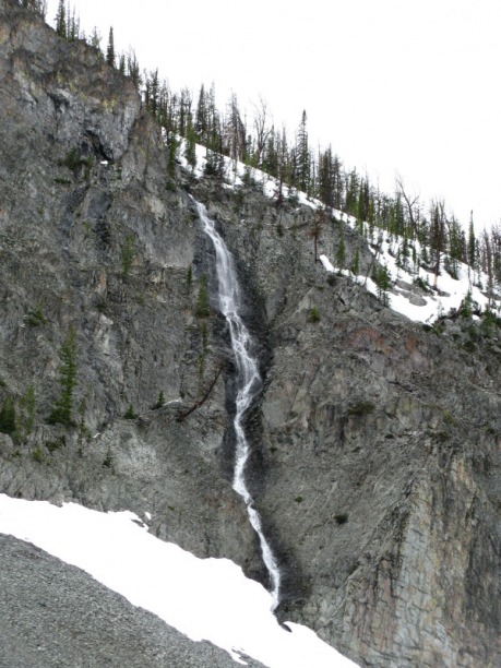
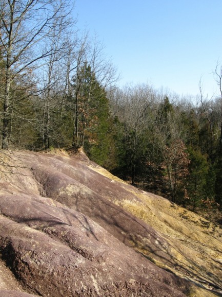
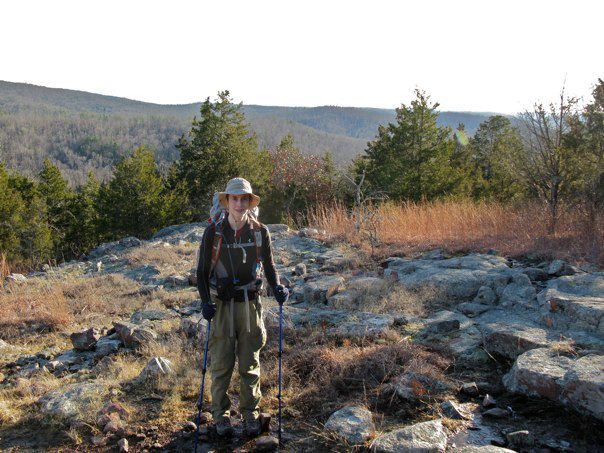
May 22 was the last Art/ Nature Field Trip of the year. Four times a year, the librarian and art teacher from North lead a group of about 20 kids to scenic natural areas around Missouri. Past destinations have been Hawn State Park, Klondike, Pickle Springs, Citygarden, Rocheport and many other spots. Last weekend, we headed south to Taum Sauk Mountain and Elepant Rocks State Parks. First, we spent an hour scrambling around the warm, pink granite boulders of Elephant Rocks. Then, we drove to Taum Sauk and ate lunch on the highest point in Missouri. After lunch, we hiked the three mile loop to Mina Sauk Falls. The glade views were awesome as usual and the waterfall was really flowing with all the recent rain.
Last weekend, my mom and I took a hike around the loop trail at Valley View Glades Natural Area. This was our first time visiting the area, and it was beautiful. We had hoped to see lots of wildflowers; we weren't disappointed. There were tons of wilflowers in the glades and some in the forest. The sections of trail that were in the glades were great. Much of the trail traveled through the forest, but the many different creeks and streams had some really neat little waterfalls on them. We spent so much time admiring the wildflowers that it took us two hours to hike the two mile loop. We'll be coming back down Highway 21 soon to hike around Victoria Glades Conservation Area.
Clifty Falls State Park is one of southern Indiana's scenic gems. The main natural feature of the park is the 300 foot deep canyon that Clifty Creek has carved out over millions of years. The canyon has four big waterfalls in it; Clifty Falls, Little Clifty Falls, Tunnel Falls, and Hoffman Falls. Clifty Falls and Little Clfity Falls are both 60 feet high, Tunnel Falls is 83 feet high, and Hoffman Falls is 78 feet high. Yesterday, my mom and I hiked a four mile loop at the park. We entered the park from the northern entrance off of Indiana 62. First, we stopped at the Clifty Shelter. After we parked the Prius, we walked 100 yards to the Clifty Falls overlook. Clifty Falls is actually two waterfalls. There is a smaller cascade first before the creek plunges 60 feet over the main falls. Just down a couple of stairways and on a side creek, Little Clifty Falls pours off another 60 ft. high cliff. Unlike Clifty Falls, you don't get a really good view of the waterfall. On the way to the Little Clifty Falls overlook, we walked right by Cake Rock. Just like its name sounds, Cake Rock looks like a gigantic slice of cake perched on the edge of a cliff. We hiked back up the stairs to our car and drove down to the Tunnel Falls Trailhead. Just down several flights of wooden and stone steps, the Tunnel Falls Overlook was on the edge of another side canyon. We got a pretty good view of the upper part of Tunnel Falls from here.
For our hike, we started at the Oak Grove Shelter and followed a spur off of Trail 5 into the canyon. The trail dropped down through several steep switchbacks before reaching the creek and Trail 2. We hiked up the rocky bed of Clifty Creek for a couple hundred yards. There isn't really a trail through here; you just walk up on the rocks next to the creek. One of the neat things about hiking in the creek is that we were right there next to lots of the little waterfalls in the creek. With the recent rain, some of the big cliffs to the west of the river had little waterfalls flowing off of them. Soon, we reached a point where a metal cable crossed the creek. There was a little Trail 5 sign hanging on the cable. We used this cable as a handline as we crossed the slippery rocks to the other side. Soon after this crossing, the trail went up to the rim of the canyon on a steep dirt trail. The forest along this strech was covered in bright green Lily of the Valley plants. We were too early to see the flowers, but the bright green was still pretty. After climbing up about 300 ft, we reached Trail 8 on the rim of the canyon. For the next two miles, we rolled up and down on the rim of the canyon. There were many great views down into the canyon and of smaller waterfalls flowing into the canyon. After about two miles, Trail 8 began a long descent back into the canyon. About half a mile later, we were back at the banks of Clifty Creek. We made another big creek crossing here and picked up Trail 2 again. We followed the creek bed up for about half a mile. Another really neat thing about hiking in the creek bed was all the fossils. The rocks of Clifty Falls State Park were just loaded with all kinds of small fossils like the kinds found at the Falls of the Ohio. When we reached Trail 4, we hiked up the switchbacks and up a side canyon to Hoffman Falls. Just like Little Clifty Falls, the view was limited, but it was still neat. After Hoffman Falls, we hiked back on the road for 10 minutes to close the loop. We hiked the four mile loop in about two hours. On the way out of the park, we hiked Trail 1 down to the Ohio River Lookout Tower. The view was pretty nice, but was ruined by the massive power plant on the banks of the Ohio River. Overall, Clifty Falls State Park is an awesome natural gem with some great scenery and waterfalls. I'm on spring break now, so we came to Indiana to visit my grandparents. Usually when we come, we stop by Falls of the Ohio State Park. The Falls of the Ohio are a two mile long strech of the Ohio River with lots of exposed Limestone. The Limestone is about 387 million years old. Three hundred million years ago, the area was covered by a shallow sea. As thousands of tiny shellfish and other sea animals died, they sank to the bottom of the ocean. Year after year after year, a thick layer formed. Eventually, the weight of the dead animals compressed the lower layers into rock. Between then and now, the sea drained away and the upper layers eroded away. Now, the Falls are one of the largest, natural fossil beds in the world. In the summer, you can spend hours wandering the exposed rock finding all kinds of neat fossils. When we went yesterday, the Ohio River was near flood stage and 95% of the fossil beds were underwater. We still went down and explored the area though. The beds that were above water had lots of cool fossils in them. At one point, I was walking on some rocks next to the river and I almost stepped on a beaver. The beaver was bigger than I thought beavers were and had a big, flat, black tail and a reddish brown fur. It jumped into the muddy water and swam away. About five minutes later, we saw the beaver again. That was the first time my mom or I had ever seen a real, live beaver. Soon after we saw the beaver, we hiked back up to the parking lot. We then tried to hike the 3/4 of a mile Woodland Loop Trail. The trail was a great, easy hike through the forest until we got to the bottomland. The recent floods had piled up tons of huge logs that totally blocked the trail. We turned around and hiked back the way we came. On the way back to my grandparent's house, we stopped at Dairy Queen and I got a delicous Mint Oreo Blizzard.
This weekend, Troop 21 had a backpacking/ advancement weekend at Taum Sauk Mountain State Park. At first, I was planning on going down Friday night and going backpacking. However, I got a cold on Wednesday and decided not to go on Thursday night. My dad still went down with the Troop on Friday at 5:30. Around eight on Friday night, I was feeling good enough to go down Saturday morning. My mom and I packed up for the backpacking trip on Friday and decided to wake up at 5:30 on Saturday to drive down there. We woke up and left St. Louis around 6:40. About two hours later, we got down to the park. Soon after our arrival, we had some adults staying in the main campground drive us 5 miles away and drop us off at the Claybaugh Creek Trailhead. From here, we hiked 5.5 miles back up to Taum Sauk Mountain. This pretty section of the Ozark Trail climbed 500 ft. through glades, pine trees, large rocks, small waterfalls, deep valleys, and pretty streams. When we arrived back at the main campsite, we ate lunch. On the hike in the morning, I started to feel bad again, and after lunch, I decided not to go backpacking. We hiked to Mina Sauk Falls with the backpackers. Then they headed down towards Devils Tollgate to camp,and we hiked back on the Mina Sauk Falls loop. The trail to Mina Sauk Falls was beautiful, passing through huge glades with great views of the valleys and mountains. With all our recent rain, the waterfall was really flowing nicely. We got back to our car around 5. We had hiked a total of about 9 miles. I didn't go to the St. Joe mountain bike race today because I wasn't feeling any better than I did yesterday. That just means the Lost Valley Luau on the 28th will be my first race of 2010. Me at Mina Sauk Falls Today, my Mom and I drove down to Meramec State Park to bushwhack to Green's Cave. My Dad and I tried to hike to the cave last year by the Sleepy Hollow route and we got kind of lost. Then, it was getting dark and we had to turn around before we got to the cave. We started our hike around 9:45 at the Hamilton Hollow Trailhead. A short distance from the trailhead, we came to an informational pavilion about the old Hamilton Hollow Iron Works. It was built in the early 1870's and only lasted three years before it went of of business. Right after the pavilion, we made the first of our 14 major creek crossings of Hamilton Creek. We followed old roads down the Hamilton Creek Valley for two miles. The valley used to be farm fields and pasture. Now, there are only brushy meadows in their place. About a mile after the trailhead, we crossed the creek and visited Hamilton Cave. Just before the cave, there was an old stone wall built on the hillside. The cave had a big opening with icicles dangling from the nearby cliffs. It was a really cool cave, but there is a big gate on it to protect the endangered Indiana bats that live inside. The stream flowing out of the cave had bright green, mossy rocks in it. Right after Hamilton Cave, the trail crossed the creek again. About 3/4 of a mile later, we crossed the creek again to visit Homestead Spring. There is a farmer's old cooling house standing in the middle of the spring. Bright, green watercress decorated the stream. Some rusty, old strands of barbed wire were strung in between trees. The old roads kind of faded out after Homestead Spring. We made another creek crossing and followed deer trails through a cedar grove. Soon, we hit an old road and followed that to the Meramec. The road disappeared and we found a narrow, rocky pathway leading to the cave. The pathway followed a scenic hillside above the Meramec River and right below towering bluffs. Before we could see the cave, we could hear the roaring stream coming out of it. We rounded a corner and came upon one of the coolest places in Missouri. Green's Cave was simply huge. The opening of the cave was massive. I read somewhere that it is the biggest cave opening west of the Mississippi River. I don't know if that's true, but it was really impressive. I didn't bring my headlight, but we hiked up into the cave quite a ways. The noise from the creek got louder and louder. Soon, we came to a spot where we couldn't hike father without getting wet. Right beyond this place, there was a three foot high waterfall. After turning around here, we followed the rugged trail up a steep, rocky gully to the bluff above the cave. This bluff has lots of pretty cedars and looked out over some farms on the other side of the river. On the way out of St. Louis, we stopped at the St. Louis Bread Company, and got bagels and bear claws. We each ate our bear claws on this bluff with a great view. After enjoying this scenic overlook, we turned around and hike out the way we hiked in. One the way back, I waded across the creek to see Pratt Spring, the spring flowed out of a small cave. It then went towards the creek, but a couple of beavers have dammed it. There is a small lake now. Right before the trailhead, we walked over to the old iron blast furnace. The big furnace was built with huge stone blocks. The inner furnace had gotten so hot, the that there is a thin layer of iron on the rocks. The hike down Hamilton Creek is really a walk through history passing the old iron works, old stone walls, spring houses, barbed wire, and overgrown farm fields reminding you of the past. Hamilton Cave The spring house at Homestead Spring The narrow path right below the bluffs The mouth of Green's Cave The waterfall in Green's Cave The view from the bluff Me standing on the bluff Today, we took a hike at LaBarque Creek Conservation Area in the snow. LaBarque Creek is one of the newest conservation areas; it was just opened two or three years ago. Previously, it had been a Nature Conservancy Area, but the area was acquired by the Missouri Department of Conservation in 2006. The MDC faced the challenge of preserving the natural beauty of the area, while allowing public access. LaBarque Creek has one of the best watersheds in the entire state of Missouri. There are 42 different fish species living in LaBarque Creek. There are sandstone canyons, piney ridgetops, and cedar studded glades in the rugged hills of the area.
There were about three to six inches of powdery snow blanketing the landscape. With our recent cold spell, we were expecting lots of frozen waterfalls, and we were rewarded with tons of icicle draped cliffs. On our four mile hike, we saw no one else. We hiked most of the trail, but did a little off-trail exploration to one of my favorite places in Missouri that is a secret. On Sunday, my family and I took a hike on Buford Mountain, we did a 6 mile out and back to Bald Knob. The views from Bald Knob were beautiful. There were many other large, rugged glades on the mountain too. On the way back, we hiked up Hughes Mountain. The summit glade was even bigger than Bald Knob and very impressive. One of the smaller glades The view from Bald Knob Hughes Mountain
RV TripIn early June, my mom and I took a 13 day trip out west in a 31 ft. RV with my aunt, uncle, and cousin, and my cousin's grandparents. We left Madison, WI around 4 P.M. on a Friday. We started our 13 hour drive to Badlands National Park. We arrived at Badlands at 3 A.M. We parked at the Big Badlands Overlook for the night, we woke up to and amazing vista of the Badlands and the White River Valley. After exploring the cliffs around Big Badlands, we drove 3 miles to the Notch Trailhead and cooked pancakes. After eating delicouis pancakes with Wisconsin Maple Syrup, we hiked the 1.5 mile Notch Trail. This scenic trail weaved its way around the outcroppings of rock on the Upper Praire before climbing up 60 ft. on a wooden ladder. The trail follow a narrow, muddy, ledge sytem to a beautiful overlook of the White River Valley. After our hike, we drove to the Visitor Center and looked around for a while. Then we left Badlands and drove to Stockade Lake in Custer State Park. Stockade Lake was located deep in the beautiful Black Hills. The next morning, we climbed Little Devils Tower. This three mile hike led to the 6,971 ft. high summit of Little Devils Tower. This beautiful hike led through grassy meadows along a creek before climbing steeply next to granite spires. The trail ended 100 yds. from the summit. The final strech was fun scrambling over grey granite to the pretty summit. The view to the east included to spectaculer Cathedral Spires. Harney Peak the highest mountain in South Dakota was a mile to the north. We ate lunch on top and then descended. After climbing Little Devils Tower, we drove to Mt. Rushmore. Mt. Rushmore was very impressive. We hiked the 1/2 mile Presidental Trail around the base of the monument. That night we camped at Sylvan Lake Campground. The next morning, we drove to Jewel Cave. We took the Scenic Tour. It led us through some of the prettiest room in the cave. I found out that 90 % of Jewel Cave has crystals on the walls. After our tour of Jewel Cave, we drove two hours to Devils Tower National Monument. Once there, we hiked the 1.5 mile trail around the base of the tower. The neat thing about the Tower Trail is as you hike around the tower, you see all the different sides. After this short hike, my mom and I hiked down the Red Beds Trail to the South Side Trail. This beautiful hike lead down through a ponderosa pine forest interspersed with scenic meadows. After about a mile of hiking, we reached the Red Beds. They were a red clay bluff above the Belle Fourche River. After standing on top of this pretty bluff, we followed the South Side Trail through the Praire Dog Town to the campground. The next day, my uncle and I woke up at 5 A.M. to start the nine hour drive to Yellowstone National Park. As we were driving by Keyhole Reservoir, we saw large herds of pronghorn. Pronghorn are an endangered type of antelope that run at speeds up to 70 miles per hour! When we reached Sheridan, WY, the skies were dark and cloudy. An hour later, we were driving high in the Bighorn Mountain and were above the clouds. The views were incredible. We arrived in Yellowstone around 1 in the afternoon. Soon the road climbed to Sylvan Pass. The other side of the snowy canyon had some beautiful waterfalls. The water from the waterfall in the picture disappeared under the snow. As we descended the west side of Sylvan Pass, we entered an area that had been burned by a wildfire. The forest was slowly recovering. On the way down, we got our first views of Yellowstone Lake. Soon after we started driving on the lakeshore, we saw our first fumaroles. Fumaroles are one of four types of thermal features. Fumaroles are vents that spew steam and gases. Geysers erupt with boiling water. Hot Spring are springs that have water in them that is often over boiling temperatures. Mudpots are little depressions filled with bubbling mud. Grizzly Fumarole becomes a series of mudpots during the spring and early summer meltoff, but later in the summer starts to spew steam and gases. When we went in early June, Grizzly Fumarole was still a collection of little mudpots. We spent the night at Canyon. When we woke up the niext morning, the was six inches of snow blanketing the forest outside. We were snowed in at our campground until 2 P.M. when the roads were plowed. Our first stop after leaving Canyon was the North Rim of the Grand Canyon of Yellowstone. We stopped at the Upper Falls of the Yellowstone Overlook. The Upper Falls was an impressive 109 ft. high waterfall. We then drove 3 miles down the bumpy road to Artist Point. Thomas Moran, a famous painter, gave Artist Point its name when he painted The Grand Canyon of Yellowstone. This was one of his most famous paintings. The view was great. You could even see some fumaroles down near the bottom of the canyon. Our next destination was Old Faithful. On the way, we stopped at Gibbon Falls and Firehole Falls. Gibbon Falls was an 80 ft. high waterfall in the middle of Gibbon Canyon. Firehole Falls was a 30 ft. high cascade on the Firehole River. Just as we arrived at Old Faithful, the geyser had just finished erupting. We went inside the Visitor Center and found out the the geyser wouldn't be erupting for an hour and a half. We decided to hike the 1.3 mile Geyser Hill Trail. The Geyser Hill Trail was mostly a boardwalk built of a geyser basin above the Firehole River. The boardwalk led past many geysers, fumaroles, and hot springs. The Geyser above is Sponge Geyser. The geyser would fill with water and start boiling, and then the water would sink down six inches and stop boiling. The geyser kept filling with water and then draining. There where many other geysers on the adaptly named Geyser Hill. There was Beehive Geyser, that was shaped like a beehive; Lion Geysers, which were four littler geysers clustered together; and Anemone Geyser which erupts every 15 minutes. Whale's Mouth Spring is a hot spring that looks similar to a wide mouth going down into the Earth. Behind the spring, you can see the Lion Group of geysers. Anemone Geyser, above, erupts every 15 minutes. Usually, the geyser looks like a little hole in the ground. Soon steam will rise from the hole. Next, the hole fills with water and starts boiling. Then, the geyser erupts 2-3 ft. in the air. The eruption lasts for about 15 seconds. Finally, the water drains back into the hole with a gurgle.
Last Saturday, my mom and I hiked the 8.2 mile Lewis and Clark Trail in Weldon Springs Conservation Area. It is a beautiful trail high on bluffs above the Missouri River. |
AuthorMy name is Ben. I love to read, hike, backpack, mountain bike, rock climb, and mountain bike race. Since there are so many great hikes in Missouri, I decided to make a website to describe them. The Mountain BikeI ride a 2010 Specialized Rockhopper Expert 29er. I've upgraded all the original parts, went 1x9 and dropped 5lbs from the stock bike.
My Road BikeI have Willier Izoard for road riding and racing.
My CX BikeI ride a 2010 Specialized Tricross
2010 Race ResultsRiver Trails Mountain Bike Challenge (Kansas)
1st Junior 15-18 Tilles Park Crit 5th Juniors 10-18 Delmarvelous Crit 5th Juniors 15-18 Greensfelder Challenge 1st Juniors 15-18 Rhett's Run 2nd Juniors 15-18 2009 Mtb. Race Results
ICCC Castlewood Race 5th Beginner 19 and under Greensfelder Classic 5th Beginner 19 and under Burning at the Bluff 3rd in Burnin Virgins Category Archives
January 2012
Categories
All
|