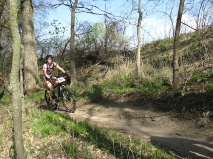
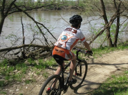
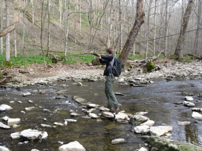
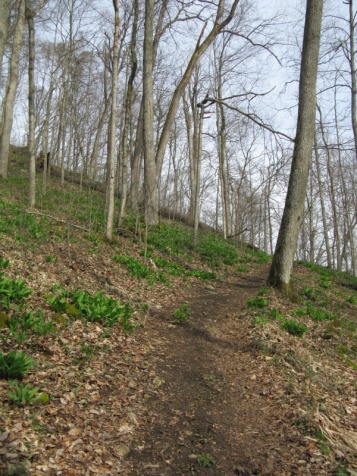
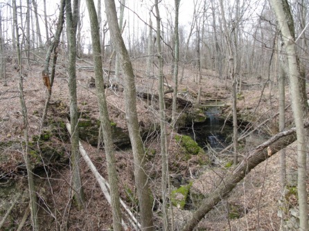
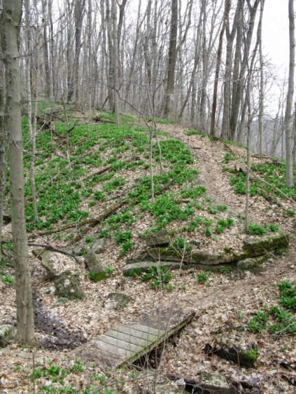
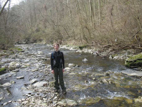
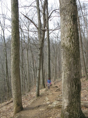
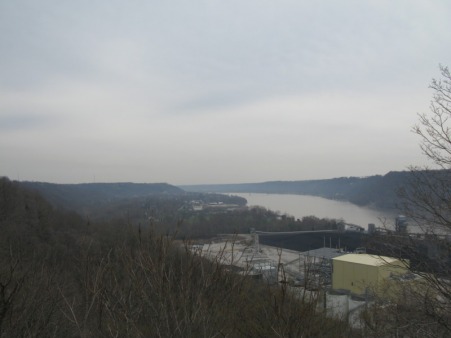
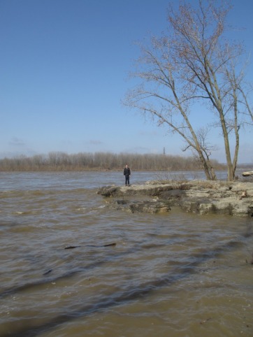
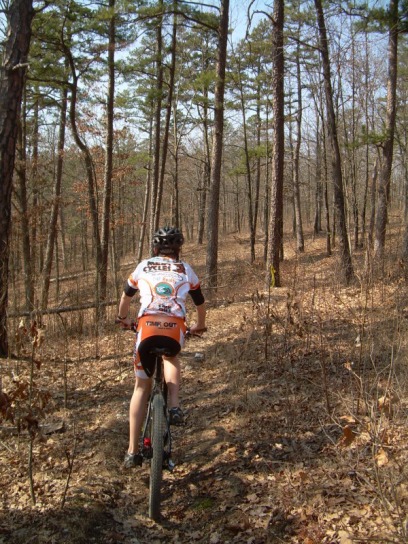
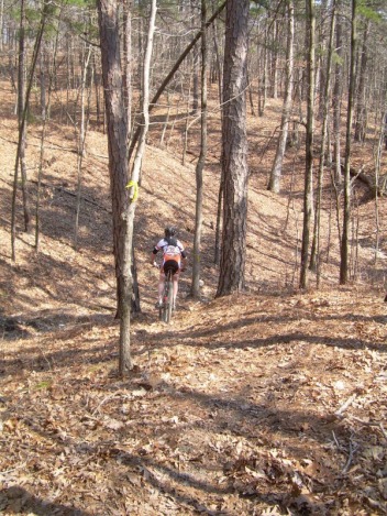
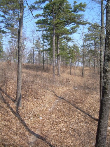
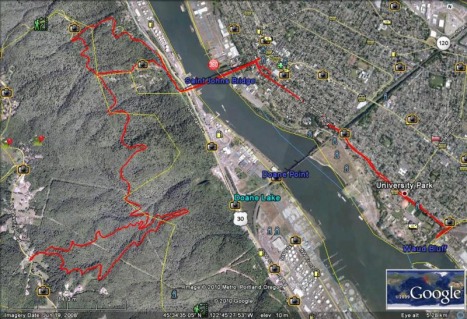
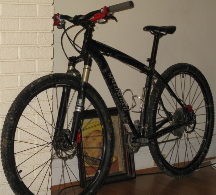
On Saturday, I started my mountain bike racing season at the River Trails MTB Race in Lawrence, Kansas. The race was held at Riverfront Park on the banks of the Kansas River. The race course was a tight, twisty 4.7 mile loop. It was mostly flat with lots of short, steep climbs and descents. It was so smooth that one racer rode his cyclocross bike. My race started at 10 with one other racer in the Junior men category; we were started with the two Junior women racers. After a short, grassy field, I entered the singletrack fourth. Within a mile, I had passed the two junior women and started to chase down the other rider in my class. Around two miles in, I caught him. In a field, I passed him and a racer in one of the beginner classes. We rode together for the rest of the first lap behind another racer. At the end of the first lap, I passed two racers ahead of me in the field at the finishing area. About a mile into the second lap, I couldn't see the other racer in my class anymore. For the rest of the race, I just kept riding at a pretty fast pace. I was passing quite a few other beginner racers. One exciting moment came when I rode around a corner pretty fast and found a three foot long black snake slithering across the trail. I came up on it so suddently that I just ran it over. I finished the race in about 44 minutes and got first in my category. I beat the other rider in my class by 1 minute and 45 seconds. For the race, I biked 9.4 miles and averaged about 13 mph. After I picked up my medal, we headed to downtown Lawrence, KS to eat lunch at Wheatfields Bakery.
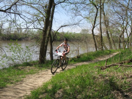
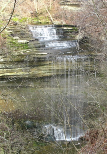
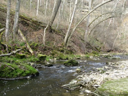
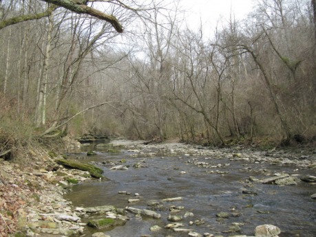
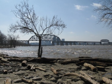
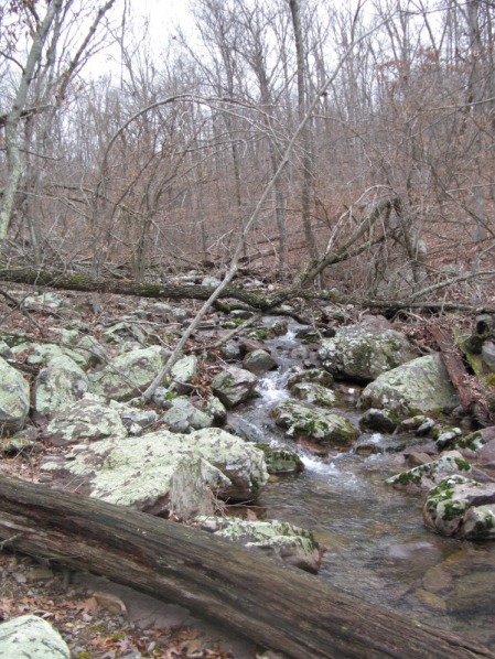
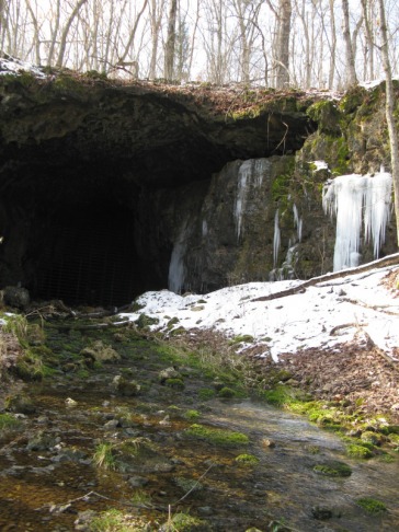
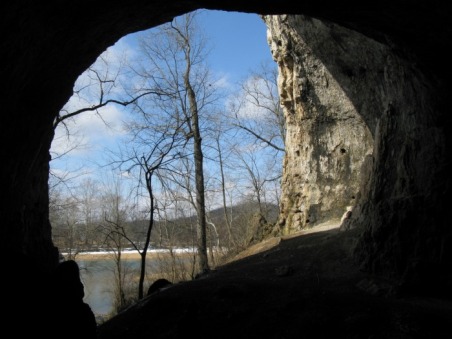
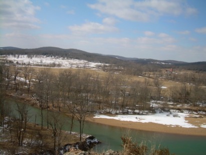
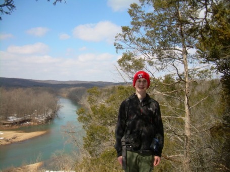
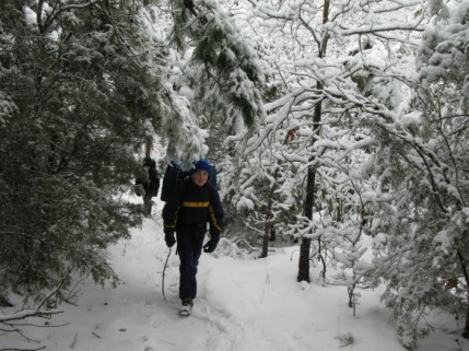
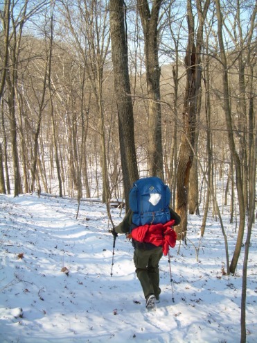
Today, I picked up my new road bike from Mesa Cycles. I ended up getting a Specialized Tricross Sport. I really like because I can ride it a road bike during the spring and summer. Then when fall comes around, I can race cyclocross on it. Right after I picked it up, I took it for its first real ride. I rode from Mesa up Clayton Road to Forest Park. I rode around the outside loop of the park twice. Wow, the road bike is so much faster and easier to pedal than my mountain bike. I rode a total of 15.66 miles. I don't have a cycling computer on it yet, but I'll be getting on soon. Now, I can do a lot more riding on the road. That'll get me in a lot better shape for mountain bike racing. Since the Lost Valley Luau was postponed, it looks like the River Trails Mountain Bike Race in Lawrence, KS on April 10th.
Clifty Falls State Park is one of southern Indiana's scenic gems. The main natural feature of the park is the 300 foot deep canyon that Clifty Creek has carved out over millions of years. The canyon has four big waterfalls in it; Clifty Falls, Little Clifty Falls, Tunnel Falls, and Hoffman Falls. Clifty Falls and Little Clfity Falls are both 60 feet high, Tunnel Falls is 83 feet high, and Hoffman Falls is 78 feet high. Yesterday, my mom and I hiked a four mile loop at the park. We entered the park from the northern entrance off of Indiana 62. First, we stopped at the Clifty Shelter. After we parked the Prius, we walked 100 yards to the Clifty Falls overlook. Clifty Falls is actually two waterfalls. There is a smaller cascade first before the creek plunges 60 feet over the main falls. Just down a couple of stairways and on a side creek, Little Clifty Falls pours off another 60 ft. high cliff. Unlike Clifty Falls, you don't get a really good view of the waterfall. On the way to the Little Clifty Falls overlook, we walked right by Cake Rock. Just like its name sounds, Cake Rock looks like a gigantic slice of cake perched on the edge of a cliff. We hiked back up the stairs to our car and drove down to the Tunnel Falls Trailhead. Just down several flights of wooden and stone steps, the Tunnel Falls Overlook was on the edge of another side canyon. We got a pretty good view of the upper part of Tunnel Falls from here.
For our hike, we started at the Oak Grove Shelter and followed a spur off of Trail 5 into the canyon. The trail dropped down through several steep switchbacks before reaching the creek and Trail 2. We hiked up the rocky bed of Clifty Creek for a couple hundred yards. There isn't really a trail through here; you just walk up on the rocks next to the creek. One of the neat things about hiking in the creek is that we were right there next to lots of the little waterfalls in the creek. With the recent rain, some of the big cliffs to the west of the river had little waterfalls flowing off of them. Soon, we reached a point where a metal cable crossed the creek. There was a little Trail 5 sign hanging on the cable. We used this cable as a handline as we crossed the slippery rocks to the other side. Soon after this crossing, the trail went up to the rim of the canyon on a steep dirt trail. The forest along this strech was covered in bright green Lily of the Valley plants. We were too early to see the flowers, but the bright green was still pretty. After climbing up about 300 ft, we reached Trail 8 on the rim of the canyon. For the next two miles, we rolled up and down on the rim of the canyon. There were many great views down into the canyon and of smaller waterfalls flowing into the canyon. After about two miles, Trail 8 began a long descent back into the canyon. About half a mile later, we were back at the banks of Clifty Creek. We made another big creek crossing here and picked up Trail 2 again. We followed the creek bed up for about half a mile. Another really neat thing about hiking in the creek bed was all the fossils. The rocks of Clifty Falls State Park were just loaded with all kinds of small fossils like the kinds found at the Falls of the Ohio. When we reached Trail 4, we hiked up the switchbacks and up a side canyon to Hoffman Falls. Just like Little Clifty Falls, the view was limited, but it was still neat. After Hoffman Falls, we hiked back on the road for 10 minutes to close the loop. We hiked the four mile loop in about two hours. On the way out of the park, we hiked Trail 1 down to the Ohio River Lookout Tower. The view was pretty nice, but was ruined by the massive power plant on the banks of the Ohio River. Overall, Clifty Falls State Park is an awesome natural gem with some great scenery and waterfalls. I'm on spring break now, so we came to Indiana to visit my grandparents. Usually when we come, we stop by Falls of the Ohio State Park. The Falls of the Ohio are a two mile long strech of the Ohio River with lots of exposed Limestone. The Limestone is about 387 million years old. Three hundred million years ago, the area was covered by a shallow sea. As thousands of tiny shellfish and other sea animals died, they sank to the bottom of the ocean. Year after year after year, a thick layer formed. Eventually, the weight of the dead animals compressed the lower layers into rock. Between then and now, the sea drained away and the upper layers eroded away. Now, the Falls are one of the largest, natural fossil beds in the world. In the summer, you can spend hours wandering the exposed rock finding all kinds of neat fossils. When we went yesterday, the Ohio River was near flood stage and 95% of the fossil beds were underwater. We still went down and explored the area though. The beds that were above water had lots of cool fossils in them. At one point, I was walking on some rocks next to the river and I almost stepped on a beaver. The beaver was bigger than I thought beavers were and had a big, flat, black tail and a reddish brown fur. It jumped into the muddy water and swam away. About five minutes later, we saw the beaver again. That was the first time my mom or I had ever seen a real, live beaver. Soon after we saw the beaver, we hiked back up to the parking lot. We then tried to hike the 3/4 of a mile Woodland Loop Trail. The trail was a great, easy hike through the forest until we got to the bottomland. The recent floods had piled up tons of huge logs that totally blocked the trail. We turned around and hiked back the way we came. On the way back to my grandparent's house, we stopped at Dairy Queen and I got a delicous Mint Oreo Blizzard.
This weekend, Troop 21 had a backpacking/ advancement weekend at Taum Sauk Mountain State Park. At first, I was planning on going down Friday night and going backpacking. However, I got a cold on Wednesday and decided not to go on Thursday night. My dad still went down with the Troop on Friday at 5:30. Around eight on Friday night, I was feeling good enough to go down Saturday morning. My mom and I packed up for the backpacking trip on Friday and decided to wake up at 5:30 on Saturday to drive down there. We woke up and left St. Louis around 6:40. About two hours later, we got down to the park. Soon after our arrival, we had some adults staying in the main campground drive us 5 miles away and drop us off at the Claybaugh Creek Trailhead. From here, we hiked 5.5 miles back up to Taum Sauk Mountain. This pretty section of the Ozark Trail climbed 500 ft. through glades, pine trees, large rocks, small waterfalls, deep valleys, and pretty streams. When we arrived back at the main campsite, we ate lunch. On the hike in the morning, I started to feel bad again, and after lunch, I decided not to go backpacking. We hiked to Mina Sauk Falls with the backpackers. Then they headed down towards Devils Tollgate to camp,and we hiked back on the Mina Sauk Falls loop. The trail to Mina Sauk Falls was beautiful, passing through huge glades with great views of the valleys and mountains. With all our recent rain, the waterfall was really flowing nicely. We got back to our car around 5. We had hiked a total of about 9 miles. I didn't go to the St. Joe mountain bike race today because I wasn't feeling any better than I did yesterday. That just means the Lost Valley Luau on the 28th will be my first race of 2010. Me at Mina Sauk Falls Today, my mom and I drove down to St. Joe State Park to pre-ride next weekend's race course. I think we finally got riding around 11:20ish. We set off from the Pim Day Use Area following yellow survey ribbon. The trail that is the race course had evidently had some illegal motorcycle use and they had left ruts. To avoid the worst of the ruts, the trail has been rerouted. These little reroutes haven't been trimmed yet, so they were just a little bit better than bushwhacking on a bike. After about three miles of reroutes, we weren't liking the trail so much, but then we crossed the paved bike path. After that crossing, we went downhill on a really fun, nice trail through a pretty pine grove. Down in the valley the trail went through a lot of little creeks and then came to the Tubes. The Tubes are three steel culverts that go under a paved bike path. The trail went through the far right one. We both walked our bikes out the end because it dropped into a really rocky creekbed. The trail continued in the valley crossing some more creeks and making a long climb back to the bike path on the ridge. After the climb, the trail went though a cool savannah area. Very soon after the savannah, my mom rode up to me and told me I had a flat. It was my rear wheel, too. Both my flats have come on my rear wheel, and both times its taken me forever to get the tire back on the bike. It took as long to put the tire back on the bike as it did to change the flat. On the positive side, I used my CO2 cartridge without wasting the whole thing. After the flat, we somehow followed orange ribbon and biked in a circle. After a little backtracking, we got back on the right path. After maybe a mile more of riding, we got back to the paved path and followed that 0.6 miles back to the trailhead. Biking through the pines Here I am dropping into one of the creek crossings. This is picture of the savannah right before I got my flat. Two weekends ago was Junior Parents Weekend at the University of Portland. Our whole family flew out to see Nate. My dad got in early Wednesday afternoon, and my mom and I got in around 10:30 at night. I spent Wednesday night at Nate's house. The next morning, I went to Nate's Coastal and Marine Systems class. It was taught by an Australian teacher. She talked about tides and how they shape the life that lives on the coast. After his class, my mom and dad picked us up and we drove to Cathedral Park to eat lunch. The park was a beautiful, grassy area below St. John's Bridge. After lunch, we played Ultimate Frisbee. After that, we dropped Nate off at his house and drove to the Columbia River Gorge. We hiked 2.3 miles up to Angel's Rest. The trail started out in a dark, old growth forest climbing up past big, mossy boulders and across talus slopes that had views of the Columbia. The trail curved into the Coopey Creek drainage. There were two pretty neat waterfalls, but you couldn't really get a good view of them. After crossing the creek on a bridge, the trail climbed through three switchbacks, and entered the area that was burned in 1991. Soon after entering this burned area, we got our first good view of Angel's Rest rising above us. The trail climbed on through around 10 more switchbacks before crossing a big talus field. This talus field had great views of the western Columbia. One more switchback, and we were on the Angel's Rest ridge. A short scramble up and we were on the summit. The views were absolutly beautiful with the Gorge and Columbia River spread out below us. The wind was blowing at a pretty steady 45 mph. We spent only 5 minutes on the top before descending. My dad and I tried to hike up Devil's Rest, but we turned around after 25 minutes of uphill hiking. Once we got back to the car, we picked up Nate from his house before going to my uncle's house. As usual, my uncle cooked an awesome meal. We watched the Olympics for a while and then went to bed. The next morning, my mom and I hiked up to Council Crest. From the top, we could see Mt. Hood, Mt. Adams, Mt. St. Helens, and Mt. Rainer. Then, we went to the Oregon Musuem of Science and Industry. I went in and saw Samson, a T-Rex skeleton. On the way to Nate's house, we stopped at IKEA and bought him a table. Once we got to his house, my dad and I set up the table in an hour. That night, Friday, we went back to my uncle Randall's house; this time, we brought one of Nate's friends, James. We ate a great salmon pasta dish and watched the Olympics some more. On Saturday morning, Parent's Weekend started with a breakfast buffet. After the breakfast, we went to a "Life After College" talk. After this, we went back to Nate's house before the President's Luncheon began. At noon, we headed over to the President's Luncheon. The catered meal was pretty good. After the luncheon, we watched one of Nate's friends in her Ultimate Frisbee game. After that, Nate and I got on mountain bikes and biked over to Forest Park. We biked over the Willamette River on the St. John's bridge. Soon, we started our climb up the famous Germantown Road. Germantown is a narrow, winding road without a shoulder heading up 1,000 ft. up the hills through Forest Park. One and a half miles of uphill riding brought us to the trailhead. From here, we biked on the Lief Erikson Trail for several miles. Then, we climbed up through some steep, muddy switchbacks and up a long fire road to Skyline Blvd. Once we hit Skyline, we had biked up 1,100 ft. from the bottom of Germantown. From Skyline, we rode down Saltzman Road. This wide open fire road descended 400 ft. over 1.5 miles. The wide, fire roads in Oregon were fun to ride down, especially because Missouri is almost all singletrack. We rode back down the Lief Erikson for several miles before going down another fire road back to the St. Johns bridge. We rode back across St. John and headed back to Nate's house. In the end, we biked 20 miles. The riding was a combination of bike lanes, sidewalks, singletrack, fire roads, and narrow roads without shoulders. The trail ranged from dusty to total mud pits. That ride was one of my favorite parts of the trip. We went back to Randall's for our last night before flying out on Sunday. At first, we were just going to send my dad out, but then, my mom and I decided to come. That was a great choice, we had perfect weather, and I had a great time. While we were driving into the Gorge, we got awesome views of Mt. Hood. One of the waterfalls on Coopey Creek. One of the smaller waterfalls on Coopey Creek Hiking across the talus field near the top of Angel's Rest Me on top of Angel's Rest Hiking up the Marquam Greenway Trail on the way up to Council Crest Here is the view of Mt. St. Helens and Mt. Rainer from Council Crest. Mt. Hood from Council Crest This is a picture of Samson, the T-Rex skeleton at the Oregon Museum of Science and Industry. Here is a Google Earth Map of our Forest Park Bike Map. On the way to the airport, we stopped at a great view of Mt. St. Helens rising over downtown Portland. Below, is the view of Mt. Hood from the same location. Sunset from the plane. When we left Portland, it was sunney and 60 degrees. When we touched down in Kansas City, it was 28 degrees, cloudy, and there were 6 inches of snow. Today, my Mom and I drove down to Meramec State Park to bushwhack to Green's Cave. My Dad and I tried to hike to the cave last year by the Sleepy Hollow route and we got kind of lost. Then, it was getting dark and we had to turn around before we got to the cave. We started our hike around 9:45 at the Hamilton Hollow Trailhead. A short distance from the trailhead, we came to an informational pavilion about the old Hamilton Hollow Iron Works. It was built in the early 1870's and only lasted three years before it went of of business. Right after the pavilion, we made the first of our 14 major creek crossings of Hamilton Creek. We followed old roads down the Hamilton Creek Valley for two miles. The valley used to be farm fields and pasture. Now, there are only brushy meadows in their place. About a mile after the trailhead, we crossed the creek and visited Hamilton Cave. Just before the cave, there was an old stone wall built on the hillside. The cave had a big opening with icicles dangling from the nearby cliffs. It was a really cool cave, but there is a big gate on it to protect the endangered Indiana bats that live inside. The stream flowing out of the cave had bright green, mossy rocks in it. Right after Hamilton Cave, the trail crossed the creek again. About 3/4 of a mile later, we crossed the creek again to visit Homestead Spring. There is a farmer's old cooling house standing in the middle of the spring. Bright, green watercress decorated the stream. Some rusty, old strands of barbed wire were strung in between trees. The old roads kind of faded out after Homestead Spring. We made another creek crossing and followed deer trails through a cedar grove. Soon, we hit an old road and followed that to the Meramec. The road disappeared and we found a narrow, rocky pathway leading to the cave. The pathway followed a scenic hillside above the Meramec River and right below towering bluffs. Before we could see the cave, we could hear the roaring stream coming out of it. We rounded a corner and came upon one of the coolest places in Missouri. Green's Cave was simply huge. The opening of the cave was massive. I read somewhere that it is the biggest cave opening west of the Mississippi River. I don't know if that's true, but it was really impressive. I didn't bring my headlight, but we hiked up into the cave quite a ways. The noise from the creek got louder and louder. Soon, we came to a spot where we couldn't hike father without getting wet. Right beyond this place, there was a three foot high waterfall. After turning around here, we followed the rugged trail up a steep, rocky gully to the bluff above the cave. This bluff has lots of pretty cedars and looked out over some farms on the other side of the river. On the way out of St. Louis, we stopped at the St. Louis Bread Company, and got bagels and bear claws. We each ate our bear claws on this bluff with a great view. After enjoying this scenic overlook, we turned around and hike out the way we hiked in. One the way back, I waded across the creek to see Pratt Spring, the spring flowed out of a small cave. It then went towards the creek, but a couple of beavers have dammed it. There is a small lake now. Right before the trailhead, we walked over to the old iron blast furnace. The big furnace was built with huge stone blocks. The inner furnace had gotten so hot, the that there is a thin layer of iron on the rocks. The hike down Hamilton Creek is really a walk through history passing the old iron works, old stone walls, spring houses, barbed wire, and overgrown farm fields reminding you of the past. Hamilton Cave The spring house at Homestead Spring The narrow path right below the bluffs The mouth of Green's Cave The waterfall in Green's Cave The view from the bluff Me standing on the bluff Last weekend, Troop 21 was supposed to take a backpacking trip to Bell Mountain, but that was canceled due to a forecasted 7 degree low. We rescheduled the trip for this weekend hoping for better weather. The temperature was better, but there was snow on the ground. I looked all over for accumulation totals, and thought I figured out Farmington had 1.5 inches. I was wrong. When we turned off I-55 onto 67, the snow just covered the trees and ground. Still, it didn’t look like any more than two inches. By the time we got another 60 miles farther southwest near the trailhead, the snow was four to six inches deep. All the vehicles made it to the snowy trailhead fine. We started our four mile hike to the summit around 10:30 under heavy grey clouds. The four mile hike was on a gentle ridgeline with some easy ups and downs. The ridge doesn’t have any view in good weather, but we didn’t need views. The snow covered trees were absolutely beautiful. The green pines and cedars were especially pretty. I was leading our group of five scouts and four adults. The snow covered trail was surprisingly easy to follow. I didn’t have any issues finding the trail for the entire hike. About three hours after we started, we made it to the top of Bell Mountain. George, John Harrison, John Zucker, and I hiked off trail for a little bit to see a glade. This glade had a great view of the snow covered hills to the northwest. After admiring this vista for a while, we continued on ¼ of a mile to our glade campsite. We camped on the edge of the main glade on the summit of Bell. Our glade had an even better view over the Shut-In Creek valley, Lindsey Mountain and the forested ridges beyond stretching to the horizon. On the way up, the forest next to the trail had about four inches of snow, but when we were on top of the open mountain, there was six inches covering the area. We set up our tents on top of the snow. After the tents were up, we ate our lunch. I wanted to bushwhack the 700 vertical feet down to Shut-In Creek, but nobody else wanted to. Anyway, we ended up not going down there. We spent the afternoon relaxing in camp. Some of us gathered firewood and others explored the cliff below our camp. We even had a little snowball fight. In the middle of the afternoon, the clouds began breaking up and some blue sky came over us. Around 4, we fired up the stoves for hot chocolate and coffee. Closer to 5, we started boiling water for our freeze-dried dinners. We had Beef Teriyaki with Rice, Beef Stew, Mexican Chicken and Rice, and Lasagna. I also brought some Idahoan Mashed Potato packets. It all tasted great in the cold air. After dinner, we walked over to our fire site where we had collected our wood. Dr. Braude was able to start a great fire with a couple of Esbit tabs. That fire was awesome at night. There is nothing that warms you up as much as a warm fire on a cold night. John Zucker let his boot get a little too close to the fire and burned part of the leather. We went to bed around 9. I slept pretty good considering it was 19 degrees. I was warm enough in my sleeping bag. Last weekend I took my 0 degree bag, but that takes up half my pack and it weighs six lbs. My 15 degree bag is still heavier than my 20 degree and a liner, so I just took my 20 degree and a liner. I should have brought my full length Themarest, but I didn’t. I think I woke up around 7:30. It was a beautiful, sunny, blue sky day. We all had some hot chocolate before eating bagels and cream cheese. By the time tents were down and we were hiking, it was 9:30. The hike back out to our cars went faster than the hike in. The soft powdery snow of yesterday was replaced with hard, icy footprints that we had made yesterday. We made it back to the trailhead with a couple of little snowball fights. We got back to the trailhead a little before noon. On the way back, the two Johns and I tried to drive his Jeep up Johnson Mountain, but the Forest Service has closed the 4wd drive road to the top to protect the ecosystem. The next time we hike around Council Bluff Lake, we’ll bushwhack up from the lake to the top of the mountain. That’ll be a more scenic way than hiking up the gravel road. Mr. Harrison dropped me off at home around 2:10. It was a great backpacking trip to a beautiful wilderness area. The six inches of snow added challenge and beauty to the already scenic area. The panorama above is the glade that was a little off the trail. The panorama below is the great view from our campsite. You can click on both of them to see them larger. Me on the summit
This weekend was supposed to be a Boy Scout backpacking trip to Bell Mountain, but that trip was rescheduled because of the cold and snow. Instead, my dad and I met Dr. Braude and David at the Osage Campsite in Greensfelder last night. My dad and I hiked in 8 miles from the northern end of the Green Rock at Rockwoods Reservation. We started our hike around 11 yesterday and headed south on the Green Rock. Barely half a mile into our hike, we both took off our fleeces. I was wearing just a baselayer and a long sleeved Under Armour shirt. The bright sun really warmed up the snowy day. There was around an inch of snow covering the hillsides. It was really pretty. Around the 2 mile mark, we met an older couple hiking a four mile out and back from Rockwoods. About five minutes later, we met a trail runner who wanted to run 18 miles that day. Just before crossing Melrose Road, we saw another trail runner. We crossed Melrose Road around 12:30; we were hiking at a steady 2 miles per hour with full packs on the snowy trail. We ate some lunch at Melrose before dropping into the Carr Creek valley and entering Greensfelder. We arrived at the Overlook Trail around 1:30 and we planned on meeting the Braudes at 3:00. We decided to hike the old Eagle Valley Trail. I wasn't expecting too much, but that trail turned out to be my favorite part of Greensfelder. The trail ran on the side of a hill in this long, beautiful glade area. There were near constant views of the hills on the other side of the valley. The glade ended right before the Mustang Trail. After that, we followed the old Eagle Valley back to the new Eagle Valley, and then hiked back to the Overlook Trail. We hiked up the steep, rocky hill to the overlook. We met the Braudes at the Osage Campsite right around 3:15. Total, we hiked about 8 miles on Saturday. They had started a small fire before we got there. As the sun was setting, we sawed more wood and set up our tents. Just before the sun set, we started up our stoves to cook our dinner. Both the Braudes and my dad had freeze dried Pad Thai; while I had Lasagna. Dr. Braude also found a pack of Idahoan Roasted Garlic and Parmesan Baby Red Mashed Potatoes that looked really good. Right after I added water to my freeze dried, I put my pot back on the stove. About a minute later, I poured some more water in it, but I burned a hole in the pot. This week, I'm going to ask the people at REI why it did that. Around 8, the moon rose in the East. It was a full moon, and it looked huge. The moon gave off so much light that it was casting shadows! I had never seen a moon shadow before; it was awesome. We hiked up to the Beulah Shelter in the moolight. After we got back, we let the fire die down. Around 9:00, we went to bed. The temperature was cold all day, but the sun warmed us during the day. We prepared for a cold night with a low forecasted in the single digits. I'm not sure how cold it really got, but it was cold. We woke up and had a small fire before hiking back out to Rockwoods. We took a couple of bushwhacking shortcuts and got back in about an hour and a half. On the way back into St. Louis, we had to stop by Krispy Kreme an get some doughnuts. My dad hiking in Rockwoods Me in Rockwoods The two pictures above this are of the glade area on the old Eagle Valley. Even though that is the old Eagle Valley, it still has the sign posts on it. The overlook Our snowy campsite
|
AuthorMy name is Ben. I love to read, hike, backpack, mountain bike, rock climb, and mountain bike race. Since there are so many great hikes in Missouri, I decided to make a website to describe them. The Mountain BikeI ride a 2010 Specialized Rockhopper Expert 29er. I've upgraded all the original parts, went 1x9 and dropped 5lbs from the stock bike.
My Road BikeI have Willier Izoard for road riding and racing.
My CX BikeI ride a 2010 Specialized Tricross
2010 Race ResultsRiver Trails Mountain Bike Challenge (Kansas)
1st Junior 15-18 Tilles Park Crit 5th Juniors 10-18 Delmarvelous Crit 5th Juniors 15-18 Greensfelder Challenge 1st Juniors 15-18 Rhett's Run 2nd Juniors 15-18 2009 Mtb. Race Results
ICCC Castlewood Race 5th Beginner 19 and under Greensfelder Classic 5th Beginner 19 and under Burning at the Bluff 3rd in Burnin Virgins Category Archives
January 2012
Categories
All
|