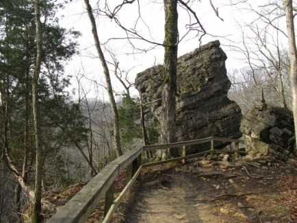
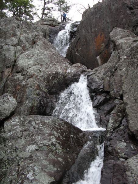
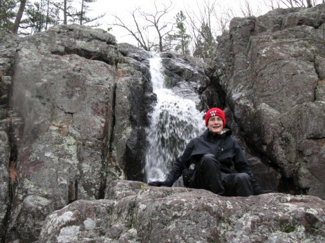
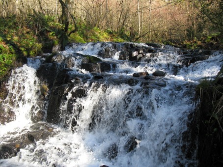
Clifty Falls State Park is one of southern Indiana's scenic gems. The main natural feature of the park is the 300 foot deep canyon that Clifty Creek has carved out over millions of years. The canyon has four big waterfalls in it; Clifty Falls, Little Clifty Falls, Tunnel Falls, and Hoffman Falls. Clifty Falls and Little Clfity Falls are both 60 feet high, Tunnel Falls is 83 feet high, and Hoffman Falls is 78 feet high. Yesterday, my mom and I hiked a four mile loop at the park. We entered the park from the northern entrance off of Indiana 62. First, we stopped at the Clifty Shelter. After we parked the Prius, we walked 100 yards to the Clifty Falls overlook. Clifty Falls is actually two waterfalls. There is a smaller cascade first before the creek plunges 60 feet over the main falls. Just down a couple of stairways and on a side creek, Little Clifty Falls pours off another 60 ft. high cliff. Unlike Clifty Falls, you don't get a really good view of the waterfall. On the way to the Little Clifty Falls overlook, we walked right by Cake Rock. Just like its name sounds, Cake Rock looks like a gigantic slice of cake perched on the edge of a cliff. We hiked back up the stairs to our car and drove down to the Tunnel Falls Trailhead. Just down several flights of wooden and stone steps, the Tunnel Falls Overlook was on the edge of another side canyon. We got a pretty good view of the upper part of Tunnel Falls from here.
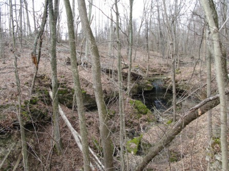
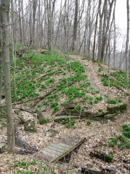
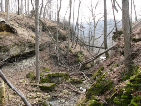
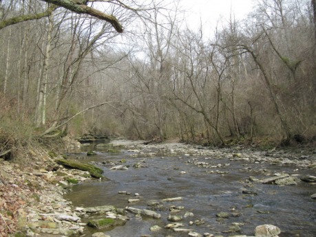
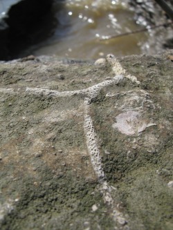
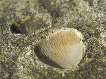
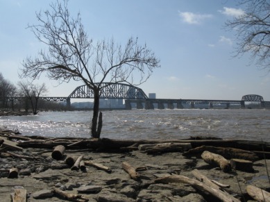
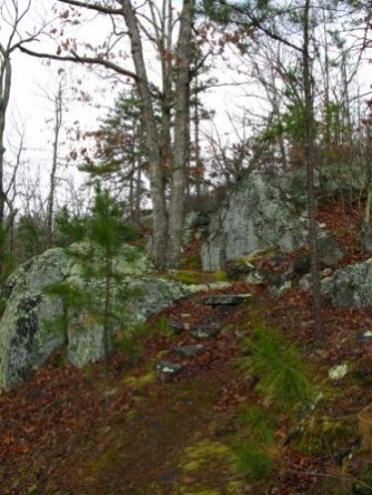
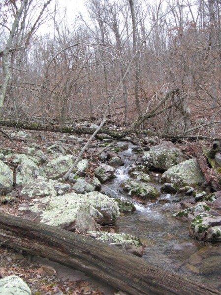
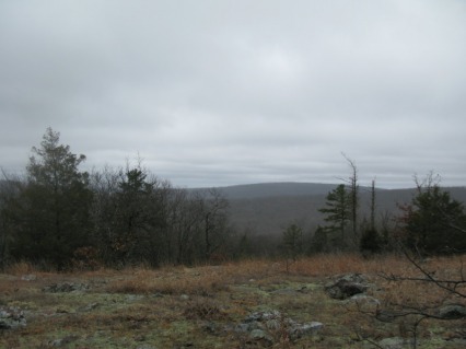
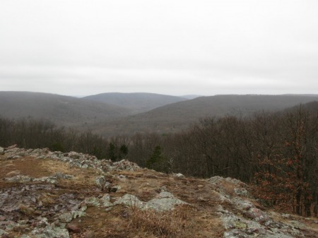
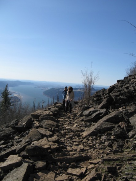
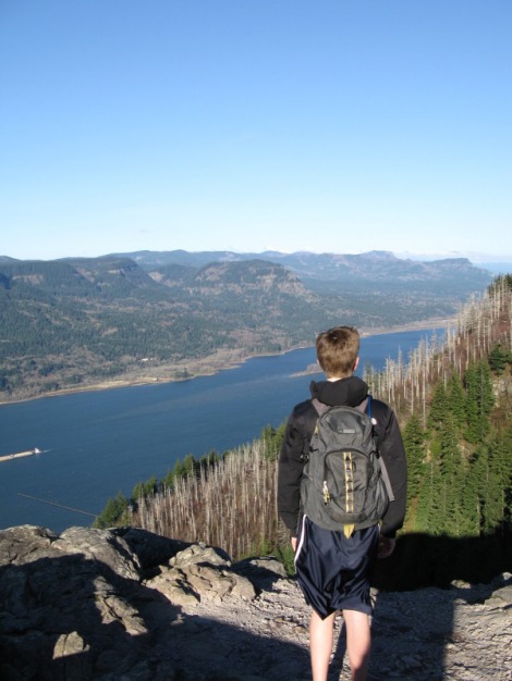
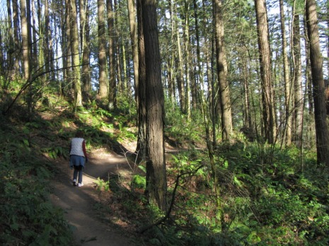
For our hike, we started at the Oak Grove Shelter and followed a spur off of Trail 5 into the canyon. The trail dropped down through several steep switchbacks before reaching the creek and Trail 2. We hiked up the rocky bed of Clifty Creek for a couple hundred yards. There isn't really a trail through here; you just walk up on the rocks next to the creek. One of the neat things about hiking in the creek is that we were right there next to lots of the little waterfalls in the creek. With the recent rain, some of the big cliffs to the west of the river had little waterfalls flowing off of them. Soon, we reached a point where a metal cable crossed the creek. There was a little Trail 5 sign hanging on the cable. We used this cable as a handline as we crossed the slippery rocks to the other side. Soon after this crossing, the trail went up to the rim of the canyon on a steep dirt trail. The forest along this strech was covered in bright green Lily of the Valley plants. We were too early to see the flowers, but the bright green was still pretty. After climbing up about 300 ft, we reached Trail 8 on the rim of the canyon. For the next two miles, we rolled up and down on the rim of the canyon. There were many great views down into the canyon and of smaller waterfalls flowing into the canyon. After about two miles, Trail 8 began a long descent back into the canyon. About half a mile later, we were back at the banks of Clifty Creek. We made another big creek crossing here and picked up Trail 2 again. We followed the creek bed up for about half a mile. Another really neat thing about hiking in the creek bed was all the fossils. The rocks of Clifty Falls State Park were just loaded with all kinds of small fossils like the kinds found at the Falls of the Ohio. When we reached Trail 4, we hiked up the switchbacks and up a side canyon to Hoffman Falls. Just like Little Clifty Falls, the view was limited, but it was still neat. After Hoffman Falls, we hiked back on the road for 10 minutes to close the loop. We hiked the four mile loop in about two hours. On the way out of the park, we hiked Trail 1 down to the Ohio River Lookout Tower. The view was pretty nice, but was ruined by the massive power plant on the banks of the Ohio River. Overall, Clifty Falls State Park is an awesome natural gem with some great scenery and waterfalls.
For our hike, we started at the Oak Grove Shelter and followed a spur off of Trail 5 into the canyon. The trail dropped down through several steep switchbacks before reaching the creek and Trail 2. We hiked up the rocky bed of Clifty Creek for a couple hundred yards. There isn't really a trail through here; you just walk up on the rocks next to the creek. One of the neat things about hiking in the creek is that we were right there next to lots of the little waterfalls in the creek. With the recent rain, some of the big cliffs to the west of the river had little waterfalls flowing off of them. Soon, we reached a point where a metal cable crossed the creek. There was a little Trail 5 sign hanging on the cable. We used this cable as a handline as we crossed the slippery rocks to the other side. Soon after this crossing, the trail went up to the rim of the canyon on a steep dirt trail. The forest along this strech was covered in bright green Lily of the Valley plants. We were too early to see the flowers, but the bright green was still pretty. After climbing up about 300 ft, we reached Trail 8 on the rim of the canyon. For the next two miles, we rolled up and down on the rim of the canyon. There were many great views down into the canyon and of smaller waterfalls flowing into the canyon. After about two miles, Trail 8 began a long descent back into the canyon. About half a mile later, we were back at the banks of Clifty Creek. We made another big creek crossing here and picked up Trail 2 again. We followed the creek bed up for about half a mile. Another really neat thing about hiking in the creek bed was all the fossils. The rocks of Clifty Falls State Park were just loaded with all kinds of small fossils like the kinds found at the Falls of the Ohio. When we reached Trail 4, we hiked up the switchbacks and up a side canyon to Hoffman Falls. Just like Little Clifty Falls, the view was limited, but it was still neat. After Hoffman Falls, we hiked back on the road for 10 minutes to close the loop. We hiked the four mile loop in about two hours. On the way out of the park, we hiked Trail 1 down to the Ohio River Lookout Tower. The view was pretty nice, but was ruined by the massive power plant on the banks of the Ohio River. Overall, Clifty Falls State Park is an awesome natural gem with some great scenery and waterfalls.
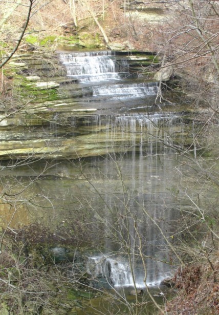
Clifty Falls
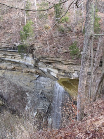
Tunnel Falls
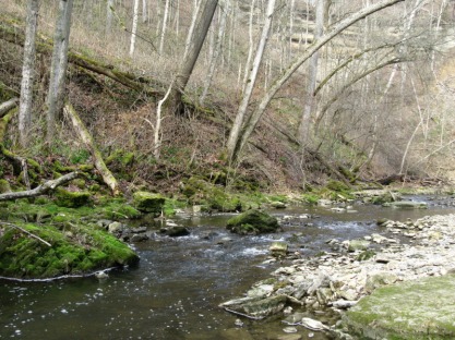
Clifty Creek
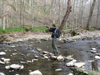
Me crossing the creek
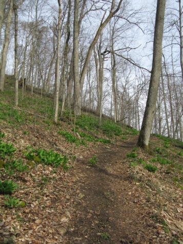
The Lily of the Valley on the climb out of the canyon
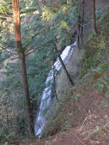
The trail crossed this creek right above the waterfall. Look closely and you can see the bridge.
One of the small side creeks we crossed
Back at Clifty Creek
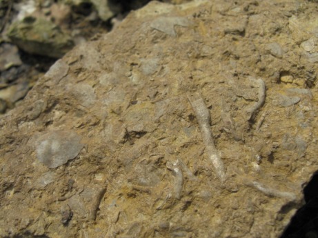
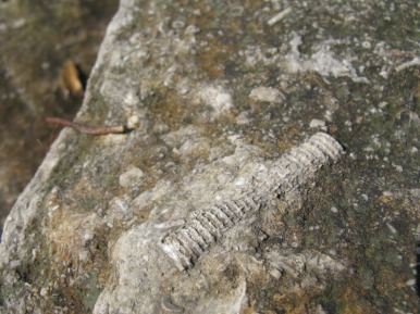
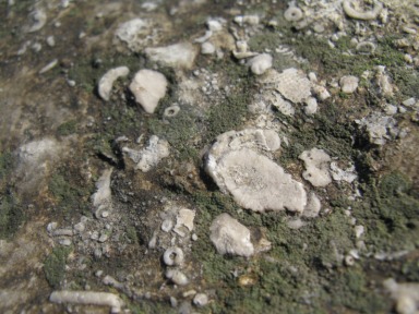
Fossils in rock next to the creek
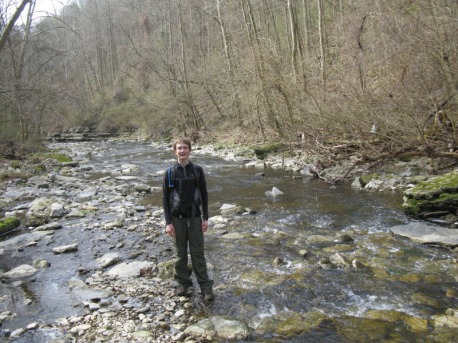
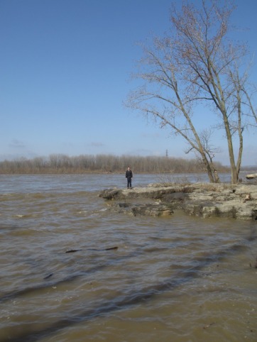
Me at Clifty Creek
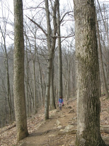
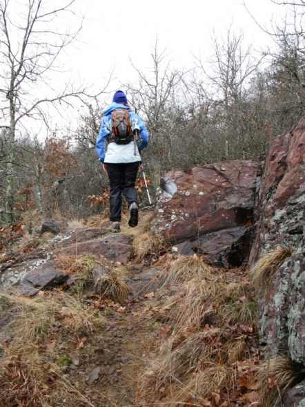
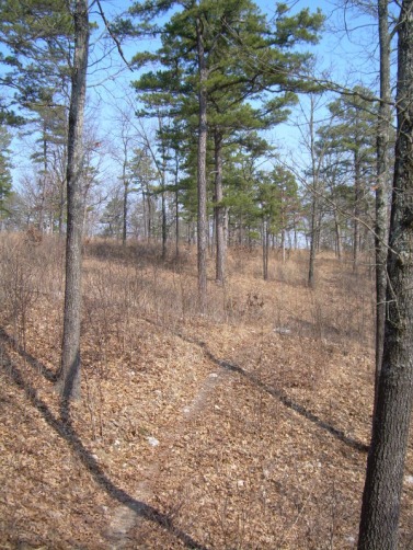
Hiking out of the canyon
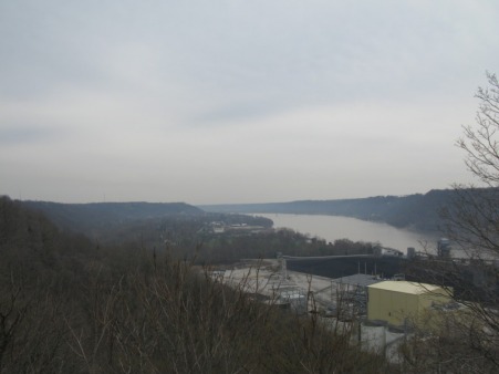
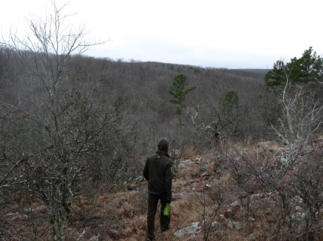
The view from the lookout tower


 RSS Feed
