Wilderness Trail, Meramec State Park, MO
Overview
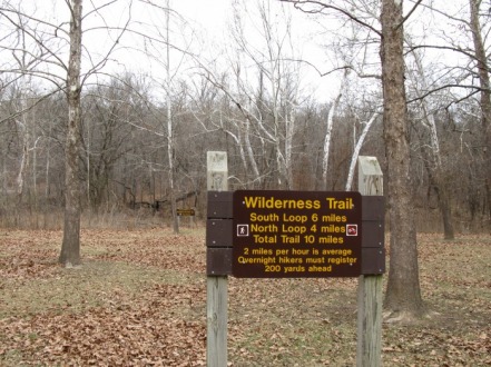
Missouri is known as the Karst State and has over 5,000 caves in its scenic hills. Meramec State Park near Sullivan has over 40 caves. The Wilderness Trail explores the most rugged and remote section of the 6,800 acre park. The trail is a 10 mile figure eight loop and has eight backpacking campsites on it. The trail has a few steep grades and long gentle streches making it an easy 4-5 hour dayhike.
Scenery : 4 Stars
Difficulty: Moderate
Length: 0.4 mile spur, 6 mile South Loop, 4 mile North Loop, 10 miles for the whole loop.
The Trailhead
From the trailhead, the trail crosses a creek on a wooden bridge, ascends up a slight hill, and meanders behind four cabins before reaching the fork 0.4 miles from the trailhead. I would recommend taking the right fork first, this way you end with a long downhill through Campbell Hollow. The trail gently ascends for a half-mile before crossing a gravel road. After the road crossing, you will quickly descend into Deer Hollow. You will pass the first backpacking campsite off to your right soon after reaching the bottom of the hollow. The trail then goes gently uphill for nearly a mile before crossing MO 185 spur.
The Pine Grove
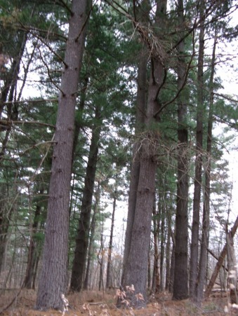
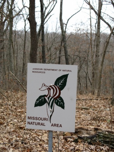
After crossing MO 185 spur, the trail levels out and enters a grove of massive pines. Some of these pine trees are two feet thick at the base! The pine needles are soft and silent as you walk through the grove. After you exit this grove there is a large sinkhole to the left of the trail. Soon after you pass the sinkhole, there is a small sign informing you that you are entering Mermamec Uplands Natural Area. See picture below.
After entering the natural area, the trail switchbacks down to the bottom of Cane Hollow. Here you meet the short cut trail; if you take a left, you will ascend gently up Cane Hollow and reach the other side of the loop in about a mile. The 10 mile trail continues to the right, and quickly climbs to the far side of Cane Hollow. The next 1.5 miles are mostly level, passing through five rugged glades that allow great views.
Glade View
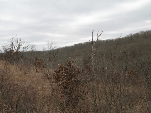
The first glade you go through is the largest, and it provides wonderfuls views to the far side of Cane Hollow. There are four more glades, each with their own great view. After 1.5 miles, the trail bends to the left and joins an old logging road.
Meramec River View
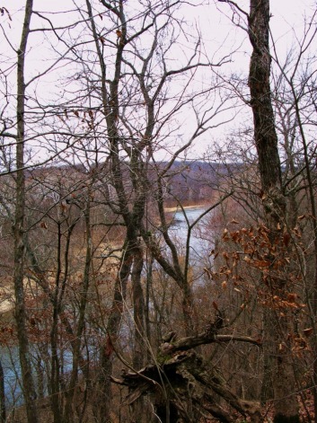
After joining the logging road, the trail swings west on top of a hill overlooking the Meramec River. You can catch scenic views of the river through the trees. The trail descends into a small hollow and goes downhill to cross a freezing cold stream on some rocks. The trail heads 100 yards up Copper Hollow and crosses another stream before reaching the prettiest spot on the whole hike.
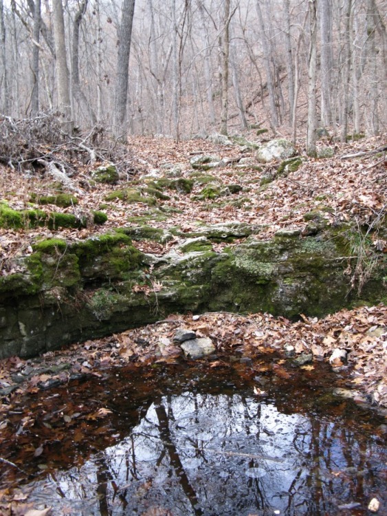
Copper Hollow Spring & Cave
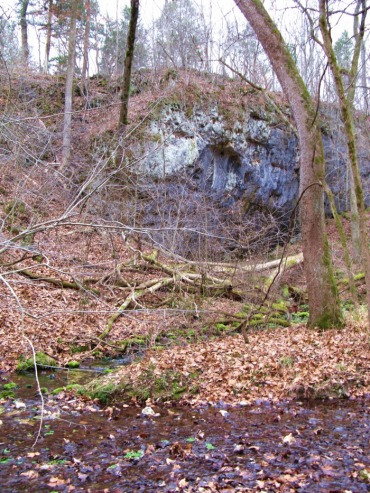
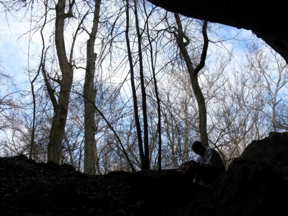
The prettiest spot on the wilderness trail, Copper Hollow Spring and Cave, is located near the 5 mile point of the hike. The spring flows out from under a 50 ft. high over hanging bliff. The stream formed by the spring has a long sheet of brillant green watercress stretching downstream. Only 20 ft. away is the entrance to Copper Hollow Cave. The actual cave is off limits unless you get a permit (inquire at the Visitor Center); but you can hike down to the mouth of the cave and look back. You'll see the sky as a distant slit.
The Entrance to the Copper Hollow Cave.

Leaving the spring, the Wilderness Trail makes a gradual two mile ascent up to the top of Copper Hollow. Along the way you will pass three backpacking campsites. There is a short and steep climb out of the hollow before passing two more backpacking sites and entering a grove of tall pines. In this grove you will meet the shortcut trail. From here the trail makes a three mile long descent through Campbell Hollow. The second crossing of MO185 Spur will happen soon after the junction.
The Rugged Upper Copper Hollow
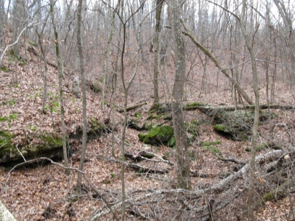
Campbell Hollow
The rugged descent through Campbell Hollow passes many small waterfalls and several backpacking camps. After passing the second backpacking campsite, the trail climbs up to a wide ledge above the creek bottom before joining the spur trail.
